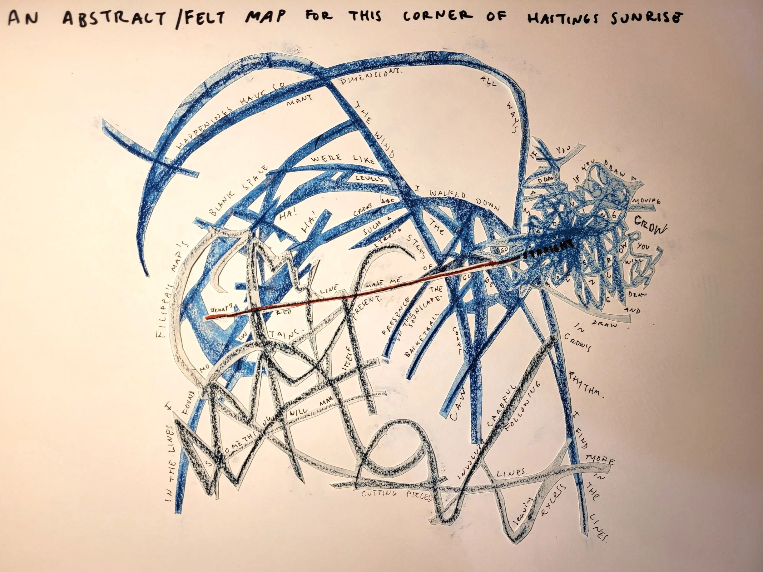
Participatory Mapping
Drawing maps is a great way of bringing people together to tell stories about the place they live in. This page shows examples of some of the workshops and projects I’ve facilitated around the idea of making maps together. Maps can be vessels for stories and memories, but they can also spark the imagination and can veer into fiction. The ways in which places are remembered or imagined may be different to different people, and I am interested in how those ‘imaginings’ can be mapped. I am also interested in what places feel like, how it feels to be a body in a space, and how felt experience of places and spaces and be captured through the process of drawing.
Sensory mapping workshop with MA Architecture Students. University of Plymouth. 2023
Participatory mapping workshops
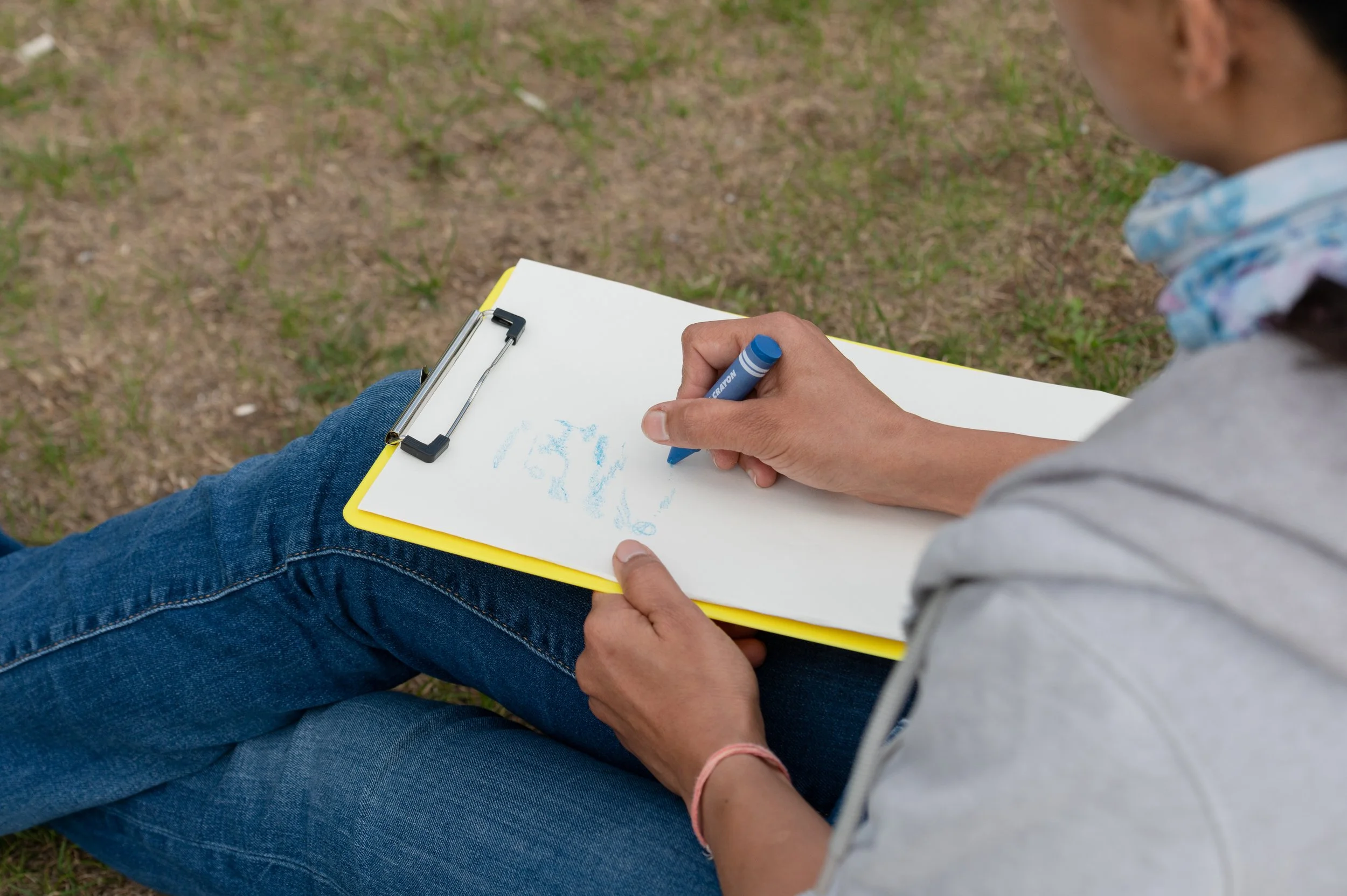
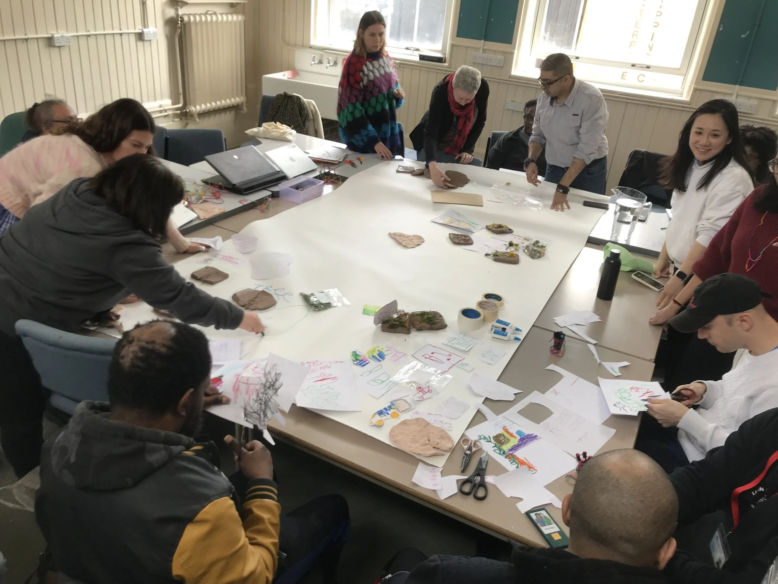
I lead participatory mapping workshops with community groups, students, professional interest groups and as outreach work for community engagement. The workshops are geared towards producing alternative ways of exploring and mapping the spaces and places where people live. The mapping exercises look towards producing a more embodied understanding of places by exploring people’s visual, sensory and emotional experiences of their neighbourhoods, and can be used to gather suggestions of how these places could be improved.
These workshops are based around the idea of using drawing as a tool to tune in, listen and record sensory experiences of how places feel, both in an emotional sense, and a physical sense - What does it feel like to be here? What do you feel in this place? How can we tune into and record these experiences through artistic processes?
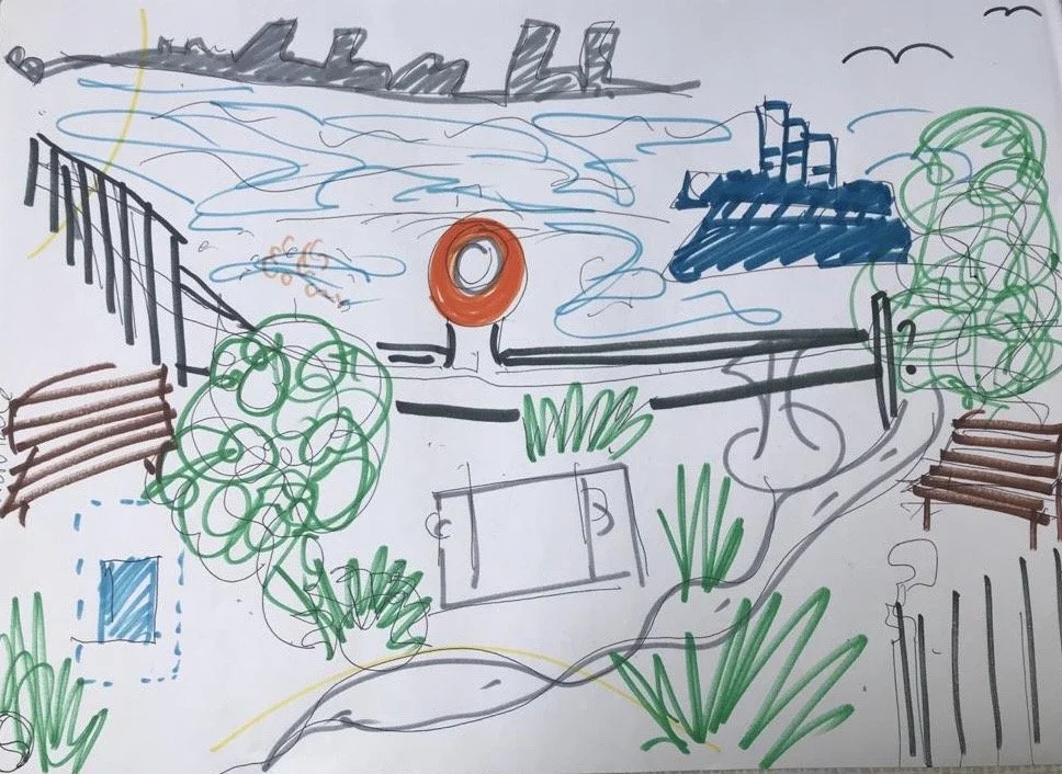
Each workshop is tailored to the context, location and group and may involve walking, listening and drawing, and then collectively creating collaged maps which are used as a tool to discuss specific issues such as physical, environmental and emotional wellbeing. Some workshops use more literal approaches, using existing maps to talk about specific experiences of locations in a particular place, whilst others involve making new maps, drawn maps, or even invented maps. Some workshops also use additional materials and techniques to capture sensory experience, such as working with clay and recording sound, photos and video.
These workshops can also be delivered online, where groups make imaginary journeys to places they know by travelling with their mind’s eye and drawing to record their experience. The artefacts and maps produced in these workshops are used to frame conversations about the places explored and depicted.
An article about a recent participatory mapping project (Livingmaps Network, Rix Centre, Purple Stars and Rosetta Arts collaboration)and the methods and processes used is published in Livingmaps Review issue 15.
Below are a selection of images from recent workshops, please tap the arrows on the side to see more pictures.
Royal Docks Design Workshop. Photo: Tian Khee Song
Royal Docks Design Workshop. Photo: Tian Khee Song
Royal Docks Design Workshop. Photo: Tian Khee Song

Walk and Draw. Photo: Tian Khee Song
Walk and Draw. Photo: Tian Khee Song
Sonic Mapping. Kings College London. 2023
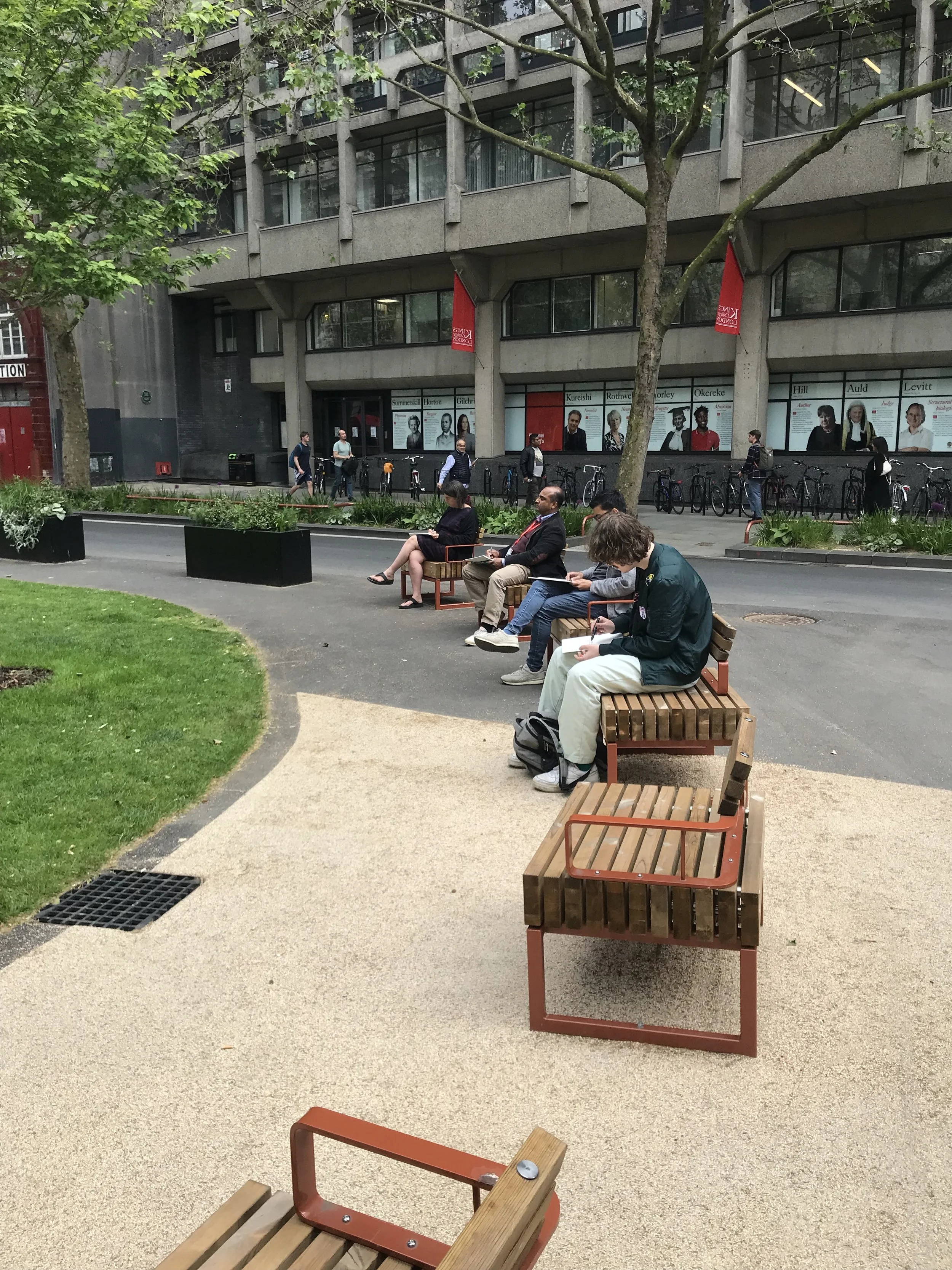
Street Furniture design feedback online workshop
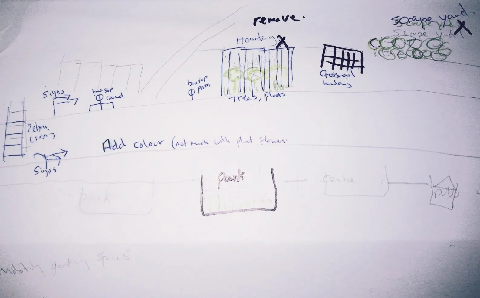
Street Furniture design feedback online workshop
Royal Docks Design Workshop. Photo: Tian Khee Song
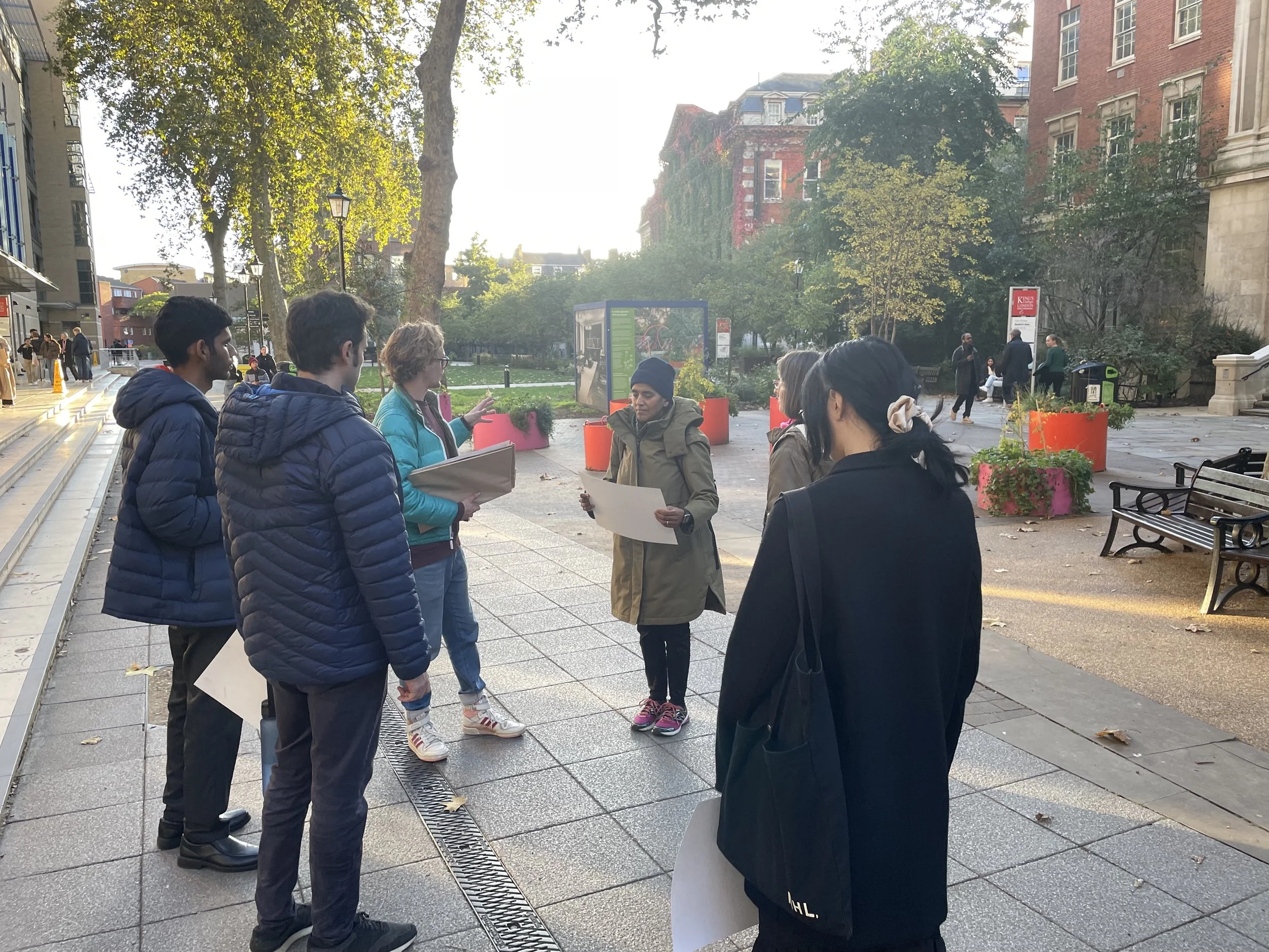
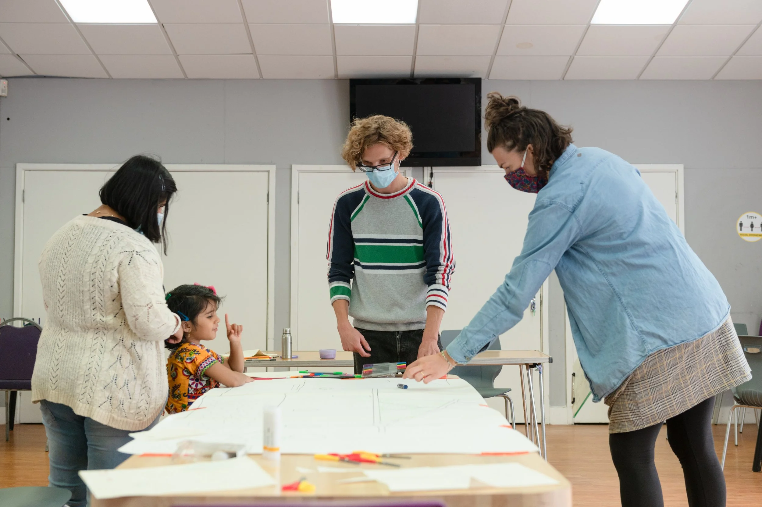
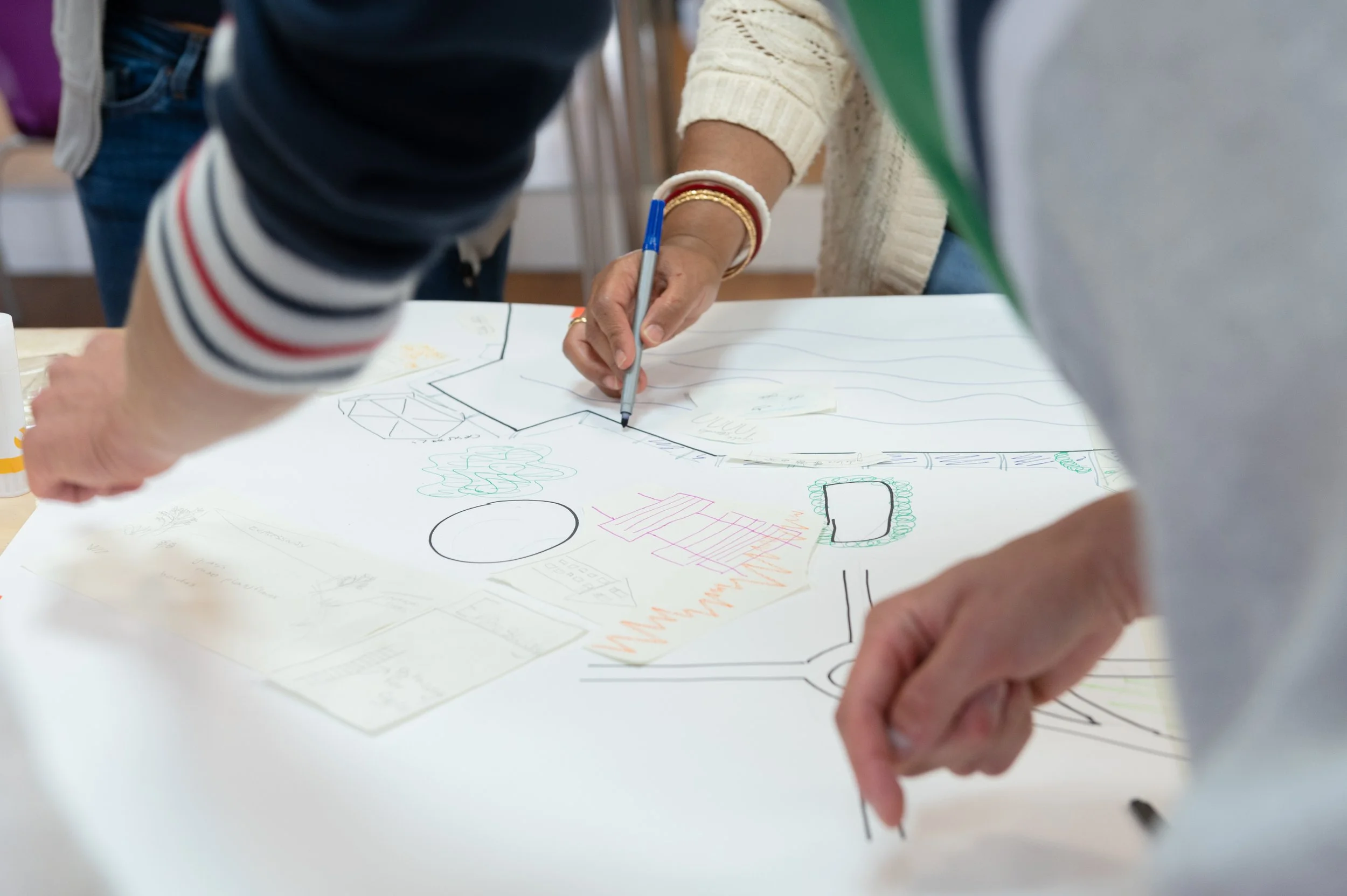
ESRC Heath and Wellbeing Mapping Workshop. The Science Gallery, 2023

ESRC Heath and Wellbeing Mapping Workshop. The Science Gallery, 2023

ESRC Heath and Wellbeing Mapping Workshop. The Science Gallery, 2023
ESRC Heath and Wellbeing Mapping Workshop. The Science Gallery, 2023
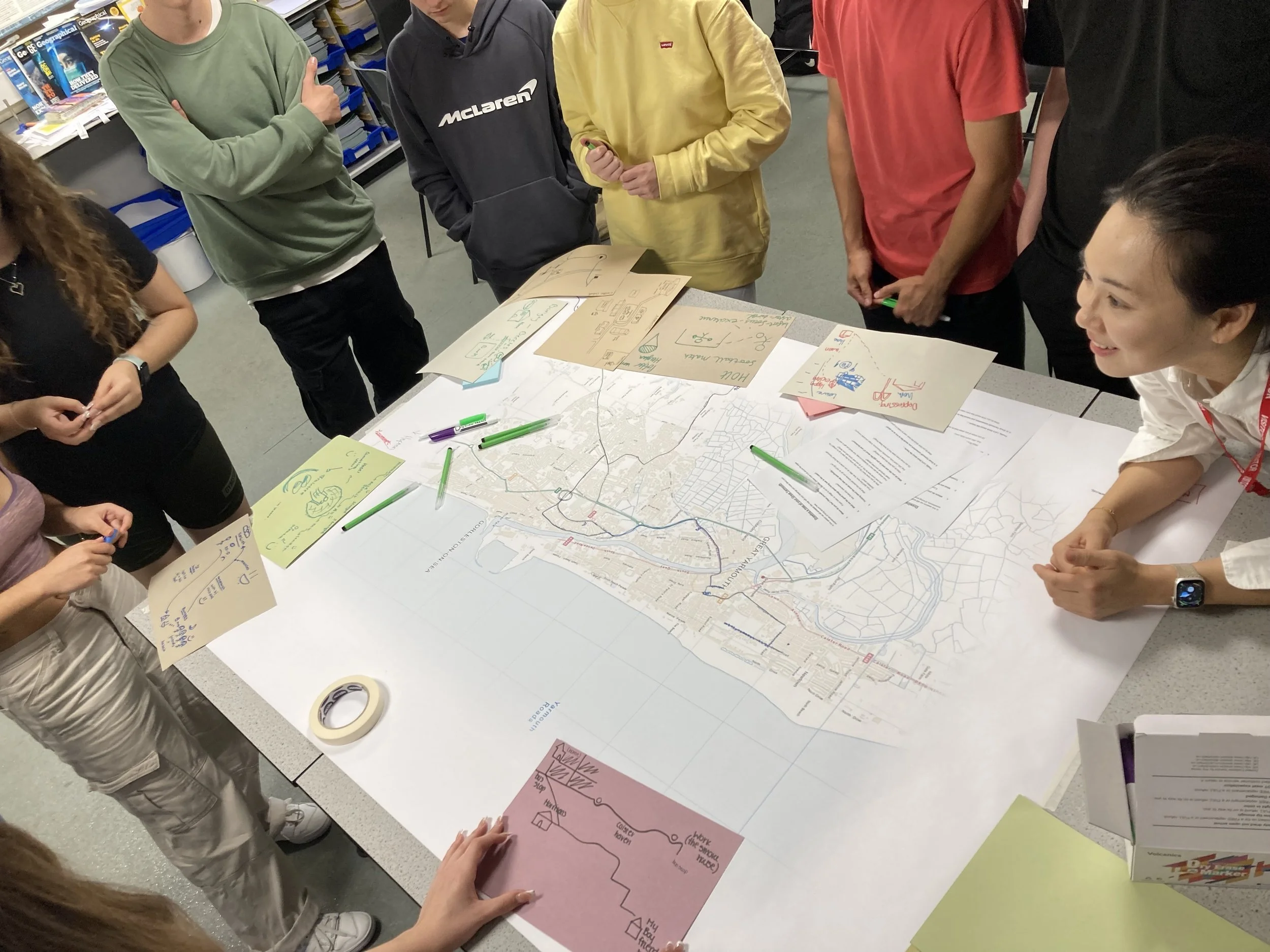
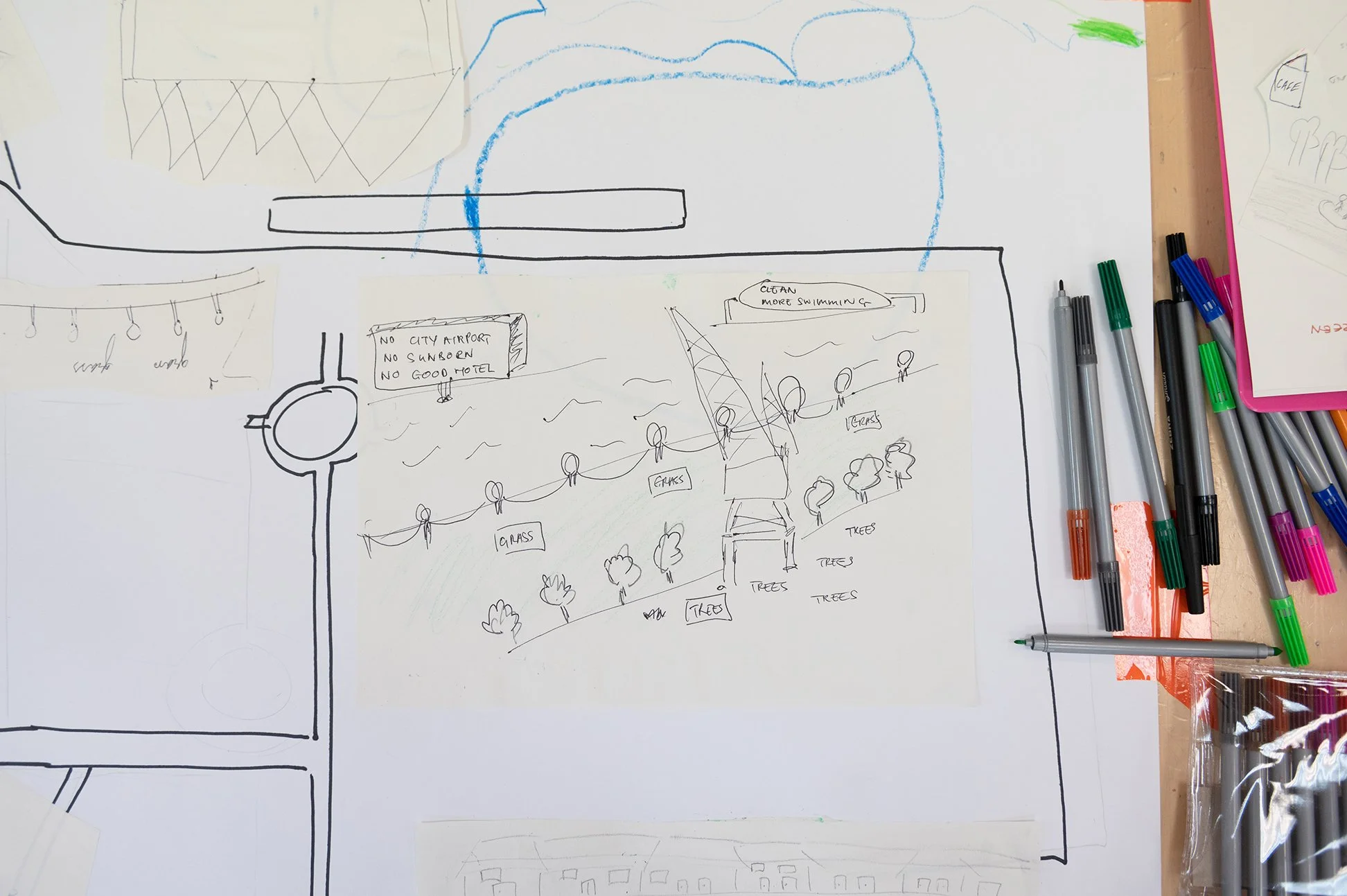
Growing up in Coastal Towns. UCL/ Livingmaps Network, 2023
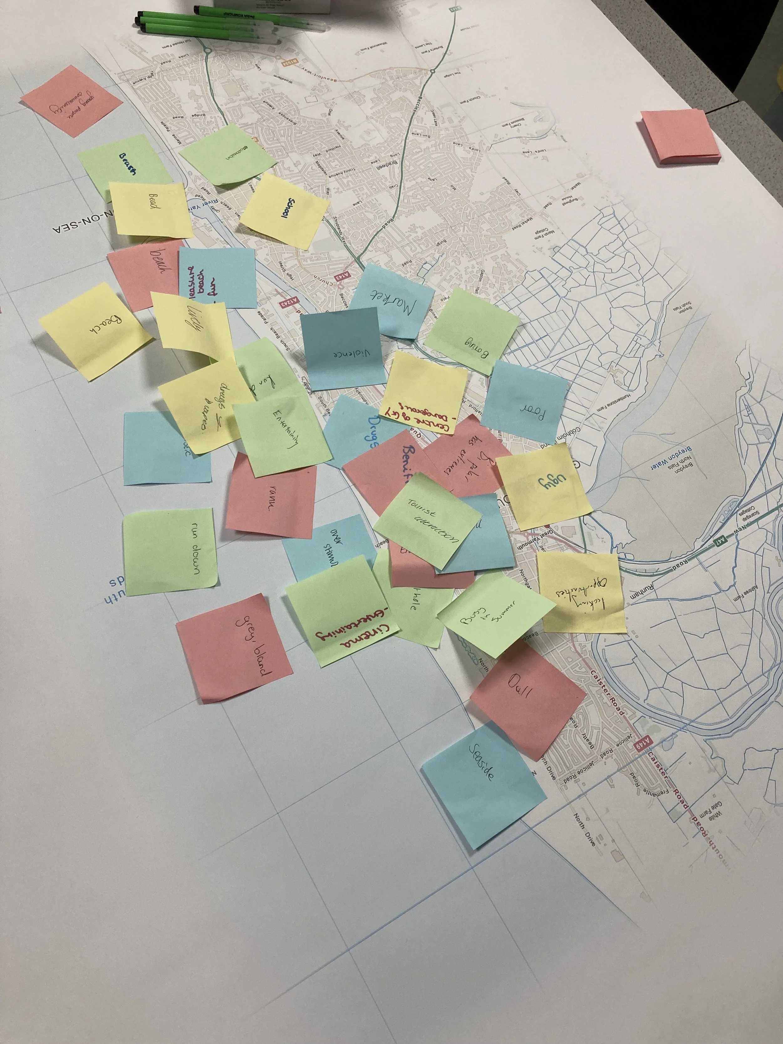
Growing up in Coastal Towns. UCL/ Livingmaps Network, 2023
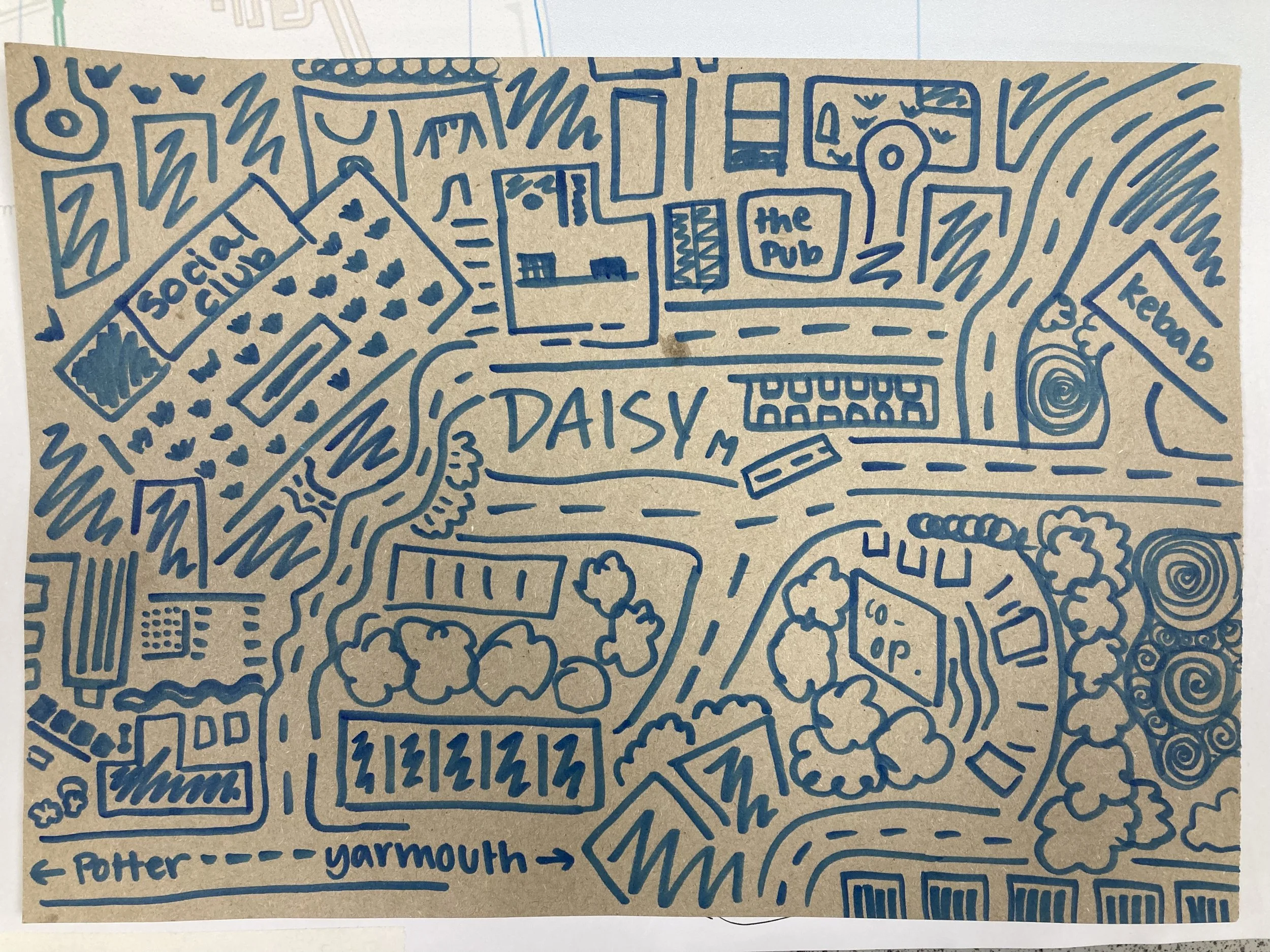
Growing up in Coastal Towns. UCL/ Livingmaps Network, 2023
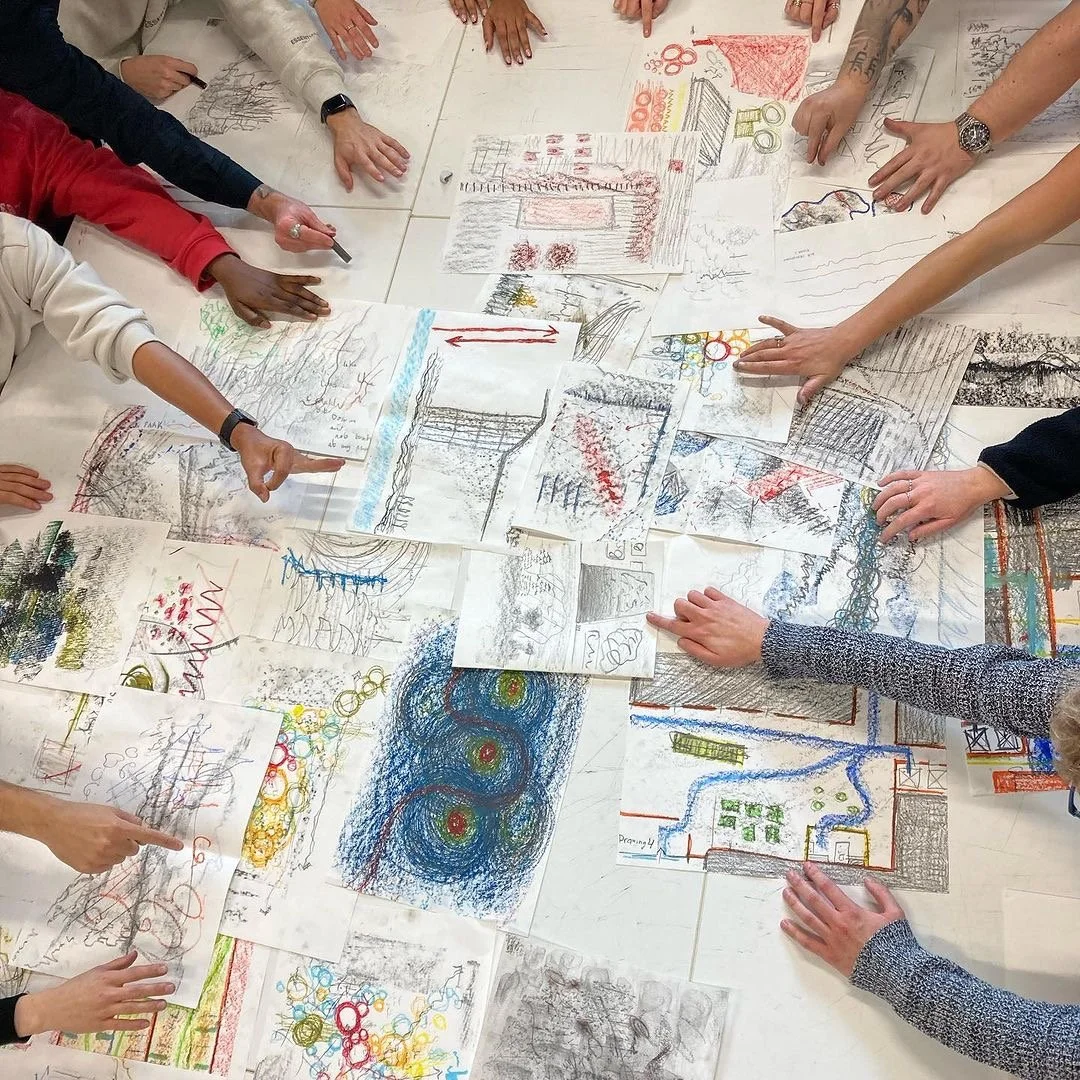
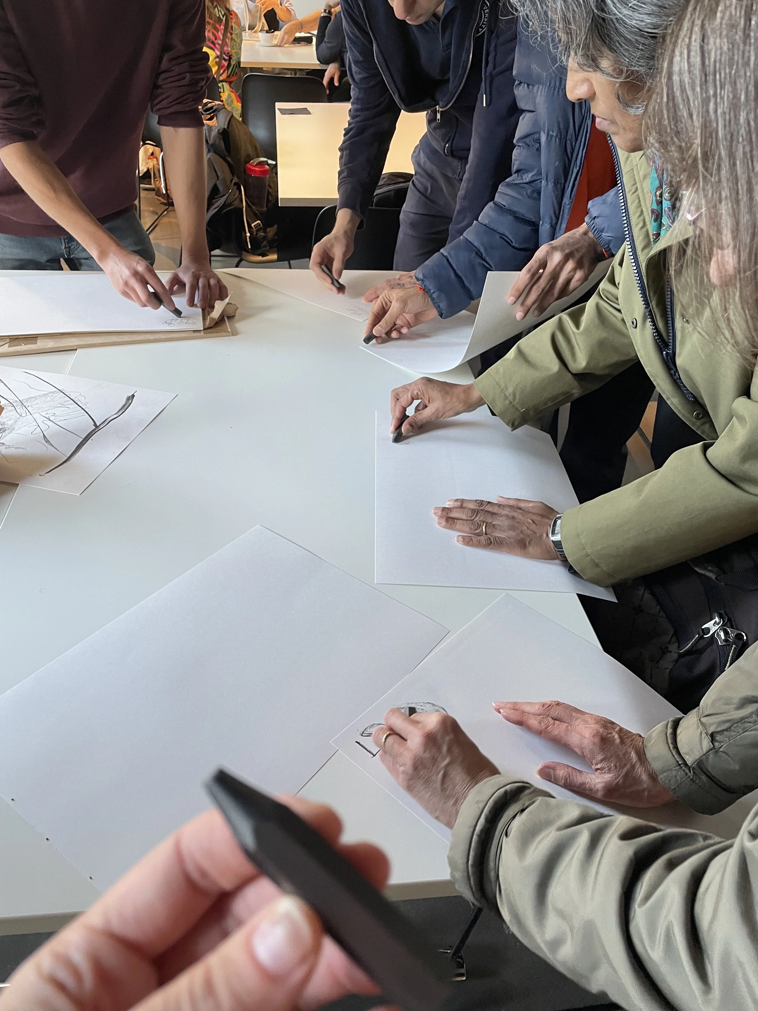
Sensory Mapping. Workshop for MA Architecture, University of Plymouth, 2023
Sensory Mapping. Workshop for MA Architecture, University of Plymouth, 2023
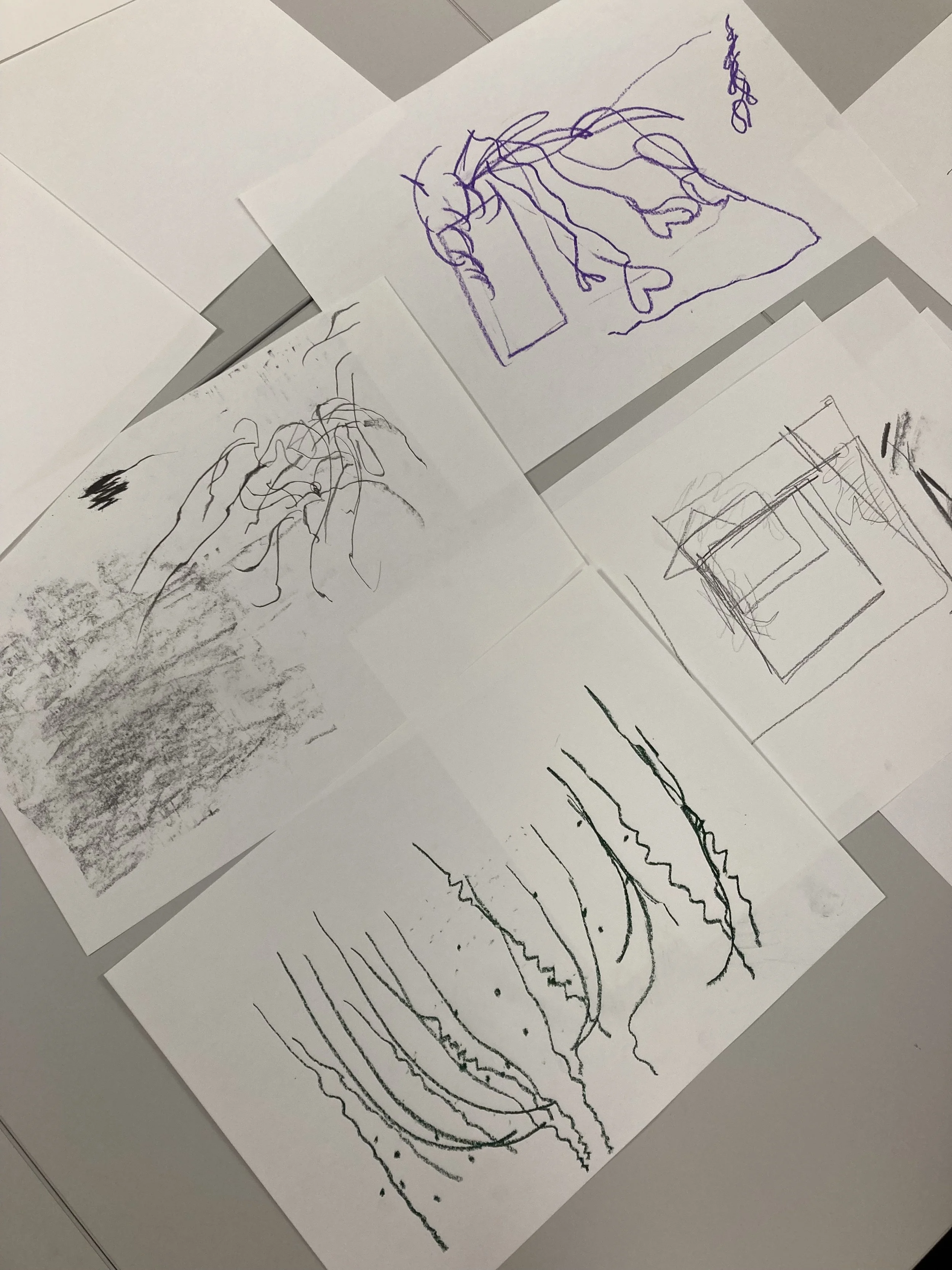
Sensory Mapping. Workshop for MA Architecture, University of Plymouth, 2023
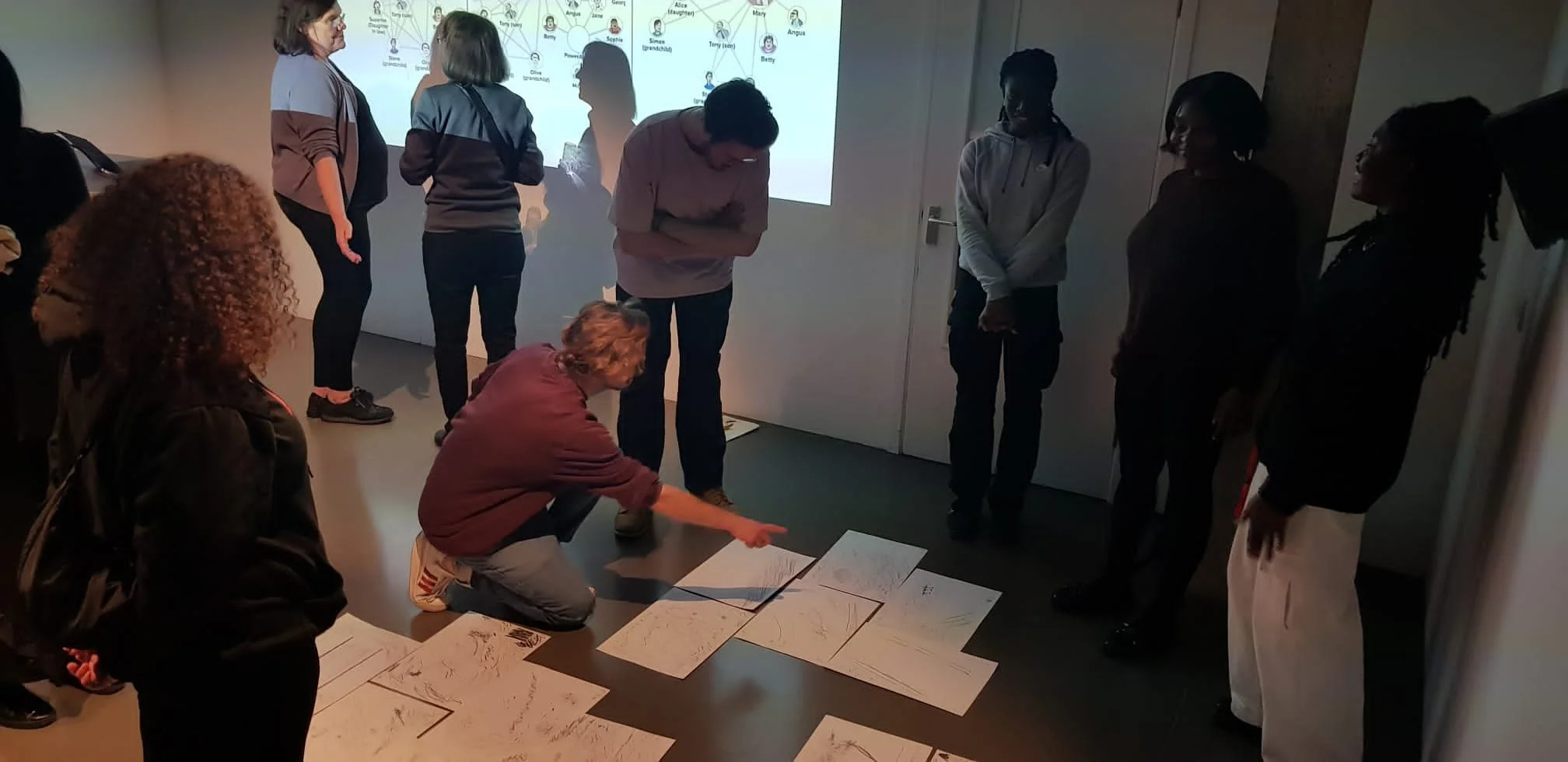
Are we that Map? Development of participatory workshop. Livingmaps Network, Rix Centre, Purple Stars, Rosetta Arts
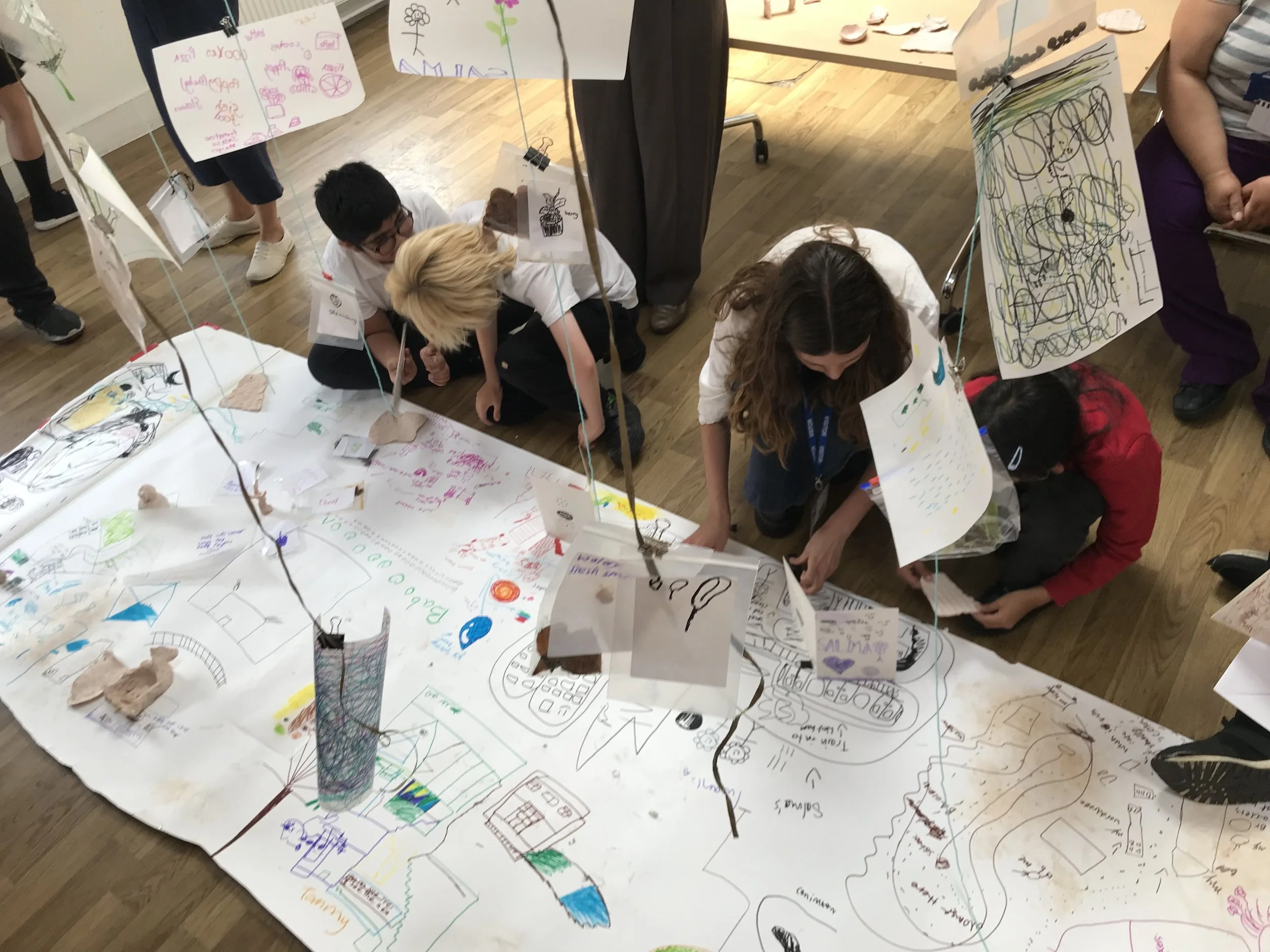
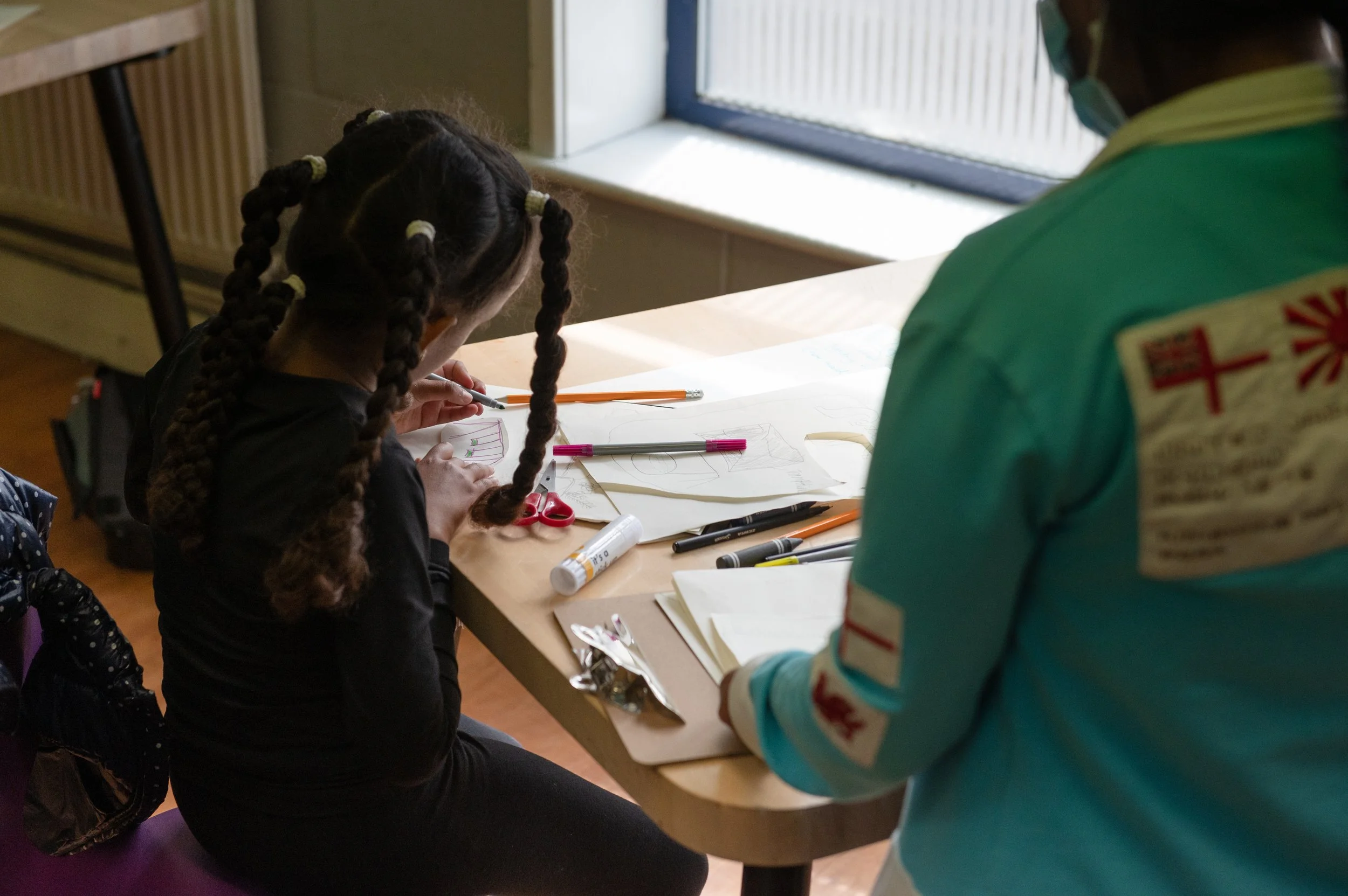
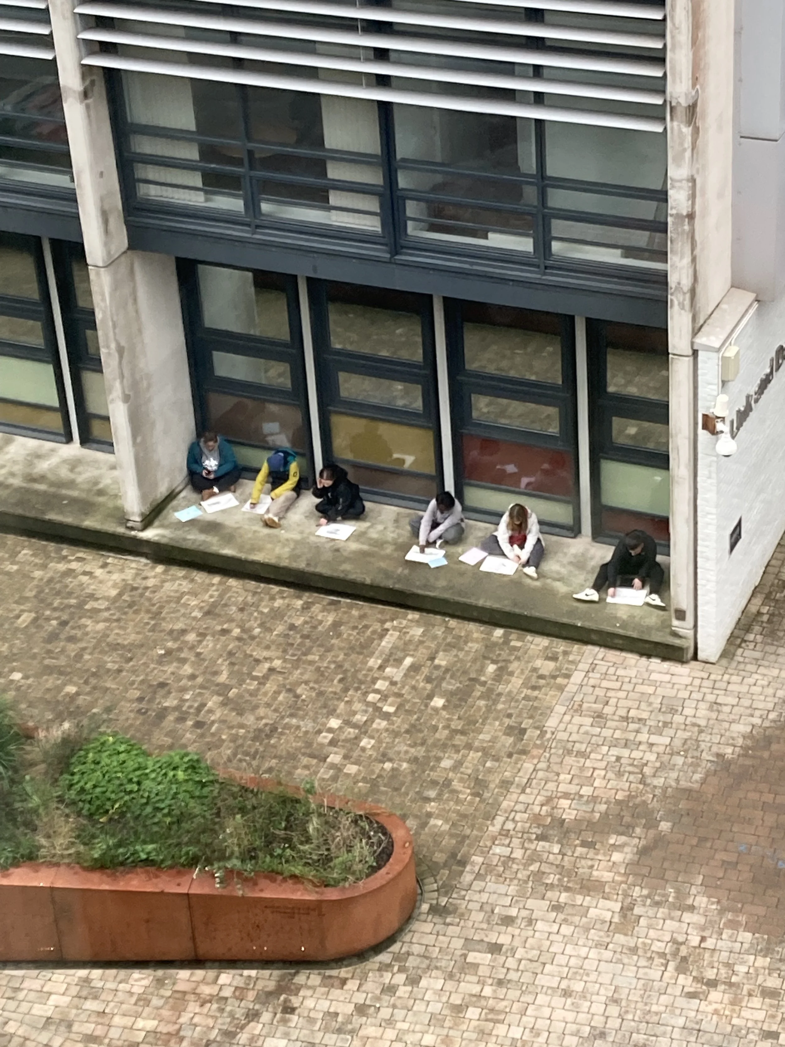
Participatory Mapping in school
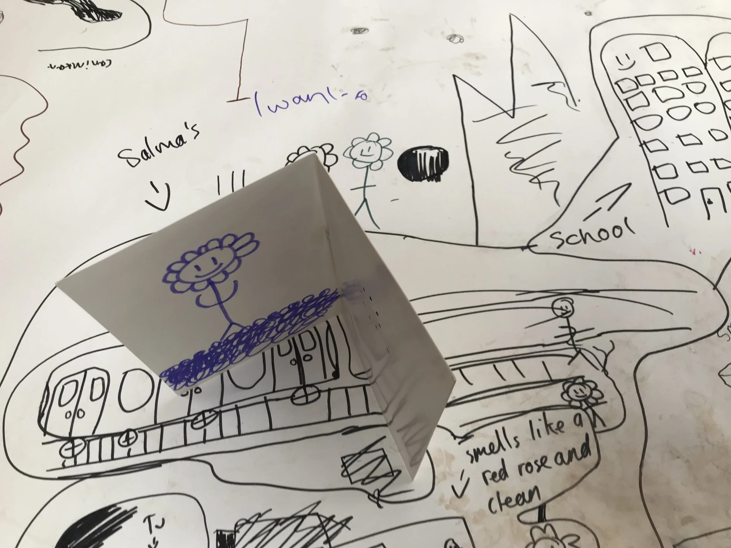
Participatory Mapping in school
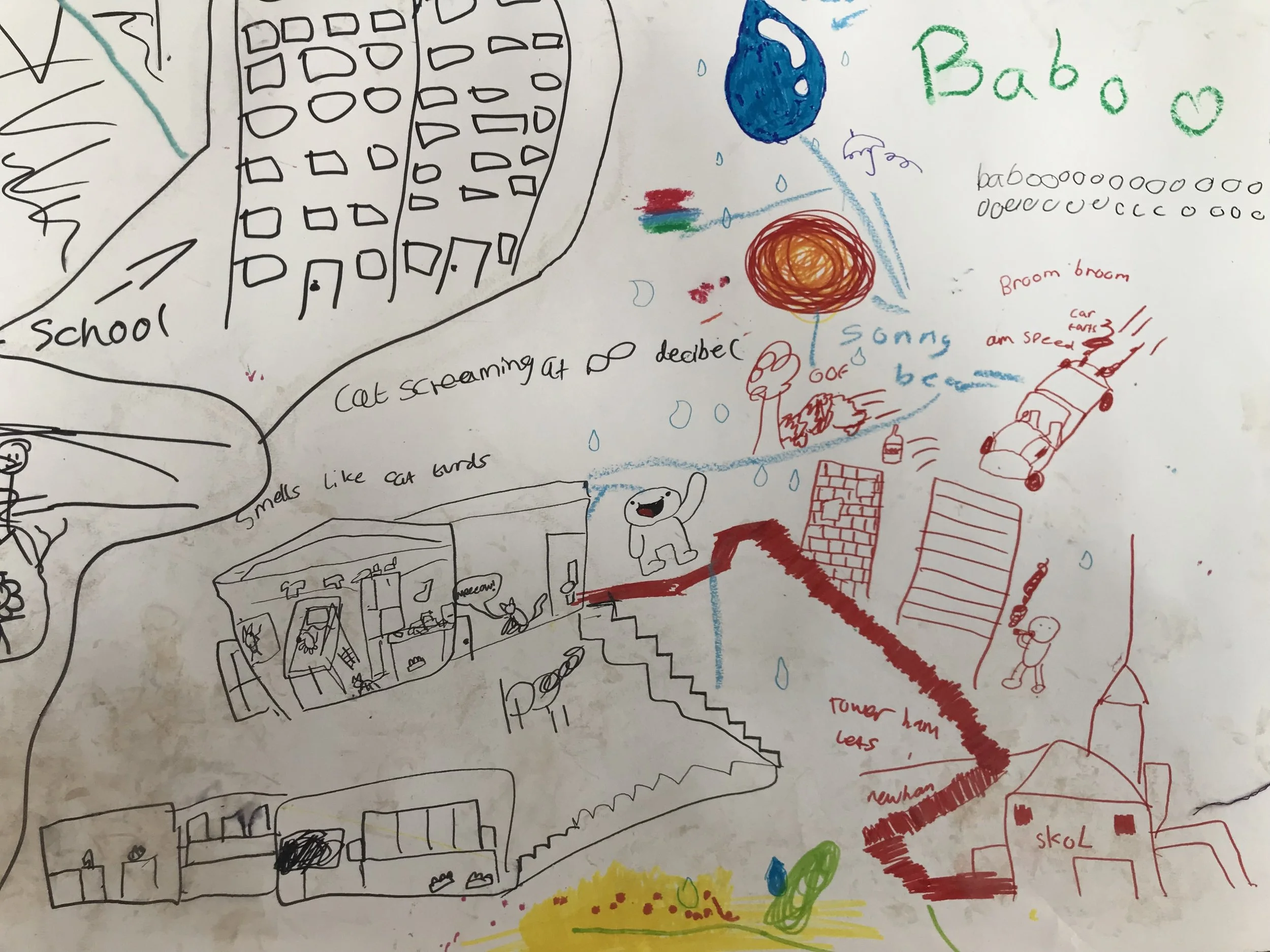
Participatory Mapping in school
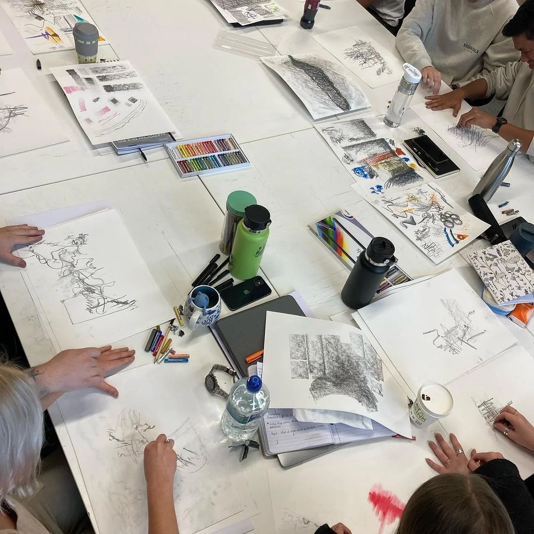
Drawing with Graphite!
FEELed Lab Workshop: Sensing a changing climate in Early Childhood
This online workshop was held at University of British Columbia Okanagan, together with the FEELed Lab in May 2024 for Undergraduate early childhood students. The workshop focussed on attuning to the embodied proximities of everyday climate events in ways that engage with their material and affectual qualities. My workshop focused on 'tuning in' to what we feel around us; exploring the textures and rhythms of environmental sound, air quality, smells, noise and other bodily sensations, and translating them through different qualities of mark making.
The workshop drew from Sylvia Kind’s research into children’s drawings, we considered how we can learn from young children’s process of mark making. We focused here not on trying to understand what a drawing is or what it represents, but rather to think of the marks, traces and gestures in a drawing as a representation in and of itself. How we draw can tell us a great deal about our relationships with ourselves, with our environments and with each other.
Students experimented with drawing their own environments during a remote walk and draw, whilst co-contaminating each other’s process by sharing images with each other online in real-time. Students then produced their own creative artifacts in a variety of media in response to the themes of the workshop.
Khezie Gibbons
Isabel Porter
Community Arts Projects
Camberwell Chalk Map
I was commissioned by the Camberwell Arts Festival (2019) to create a giant chalkboard map of Camberwell, my local neighbourhood at the time. Camberwell locals who attended the festival were invited to contribute to the map by drawing on places that were personally significant to them. This could have included places that were there currently, as well as places that no longer exist. The map was not to scale, and participants had to determine for themselves where to locate their place on the map which meant that certain streets appeared multiple times. Historically significant spots such as Sultan Street, London’s most notorious slum and the former Melhuish flour mill appeared on the map, recommendations of where to buy the best sourdough bread, as well as more personal spots such as ‘Jamal’s House’. The chalk map was both a playful exercise in collaborative drawing as well as a conversation starter about places in the area and their significance.
The map was briefly exhibited in a local empty shop unit, before I the boards into small fragments and used them as surfaces to paint on, making sure to preserve traces of the map drawing underneath.
Click here to watch a recording of a webinar about the Camberwell chalk map project
The map was subsequently geo-referenced and included as an interactive layer on the Layers of London website. It also won a public vote on Twitter as Layers of London’s ‘Greatest Layer of All Time’
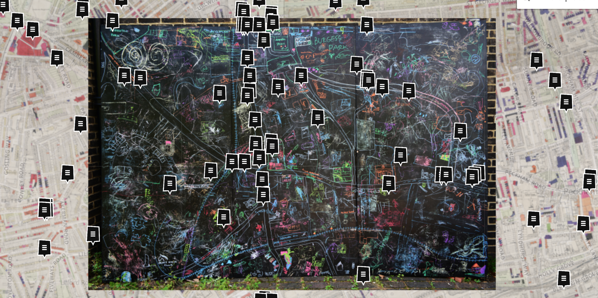
Georeferenced layer on Layers of London website

Camberwell Chalk Map, Camberwell Arts Festival 2019
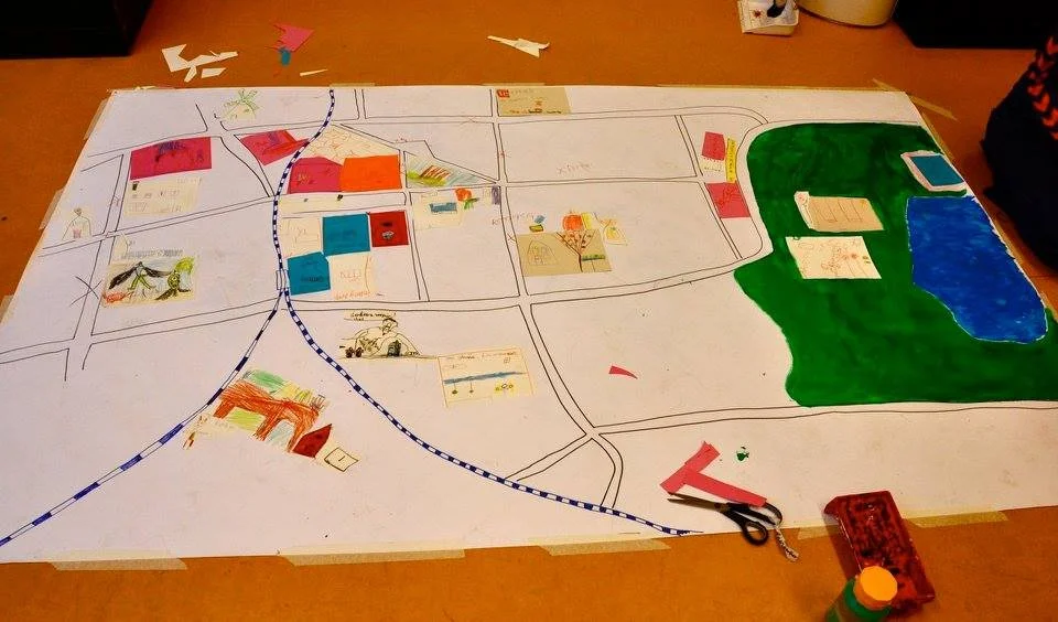
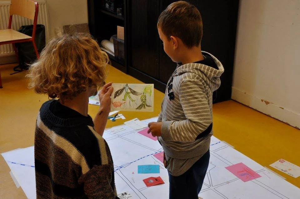
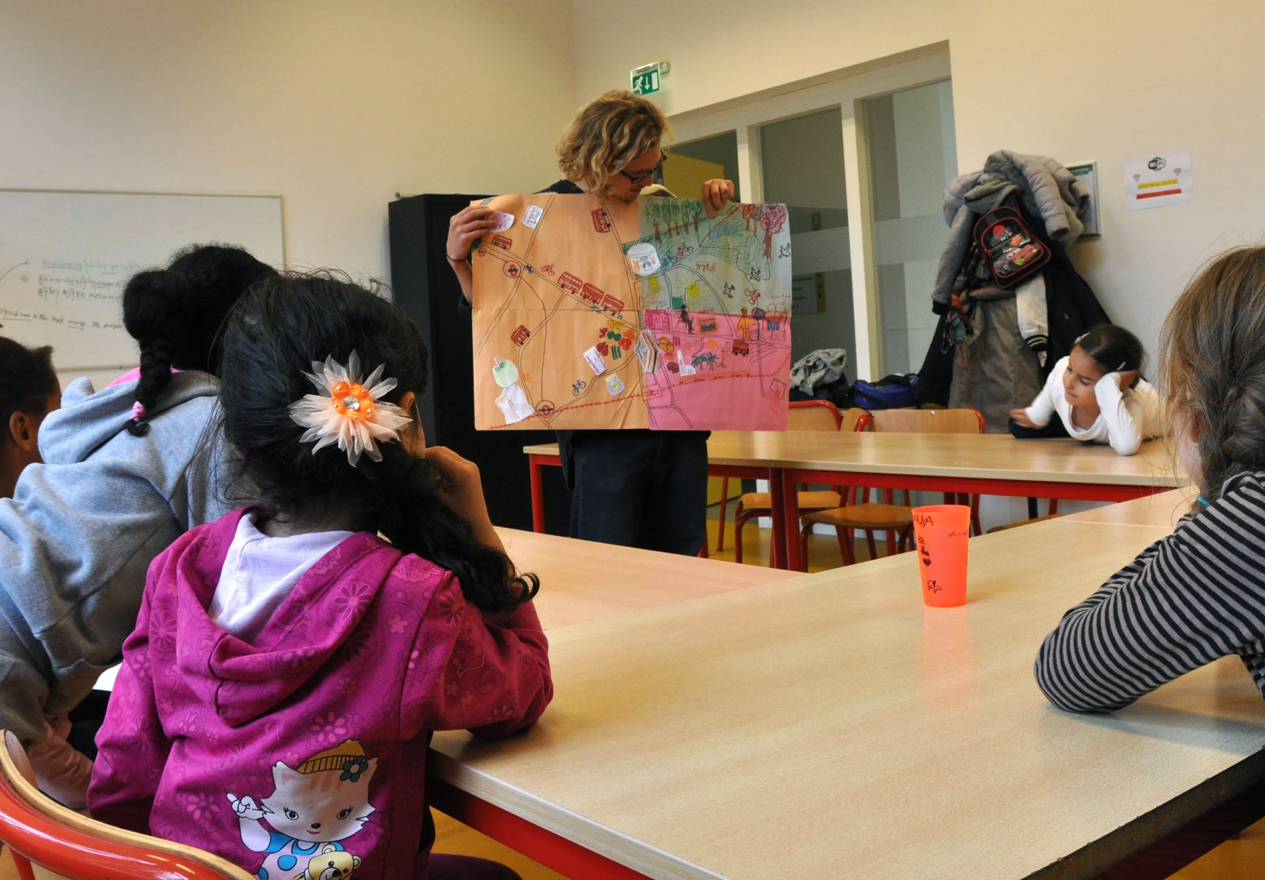
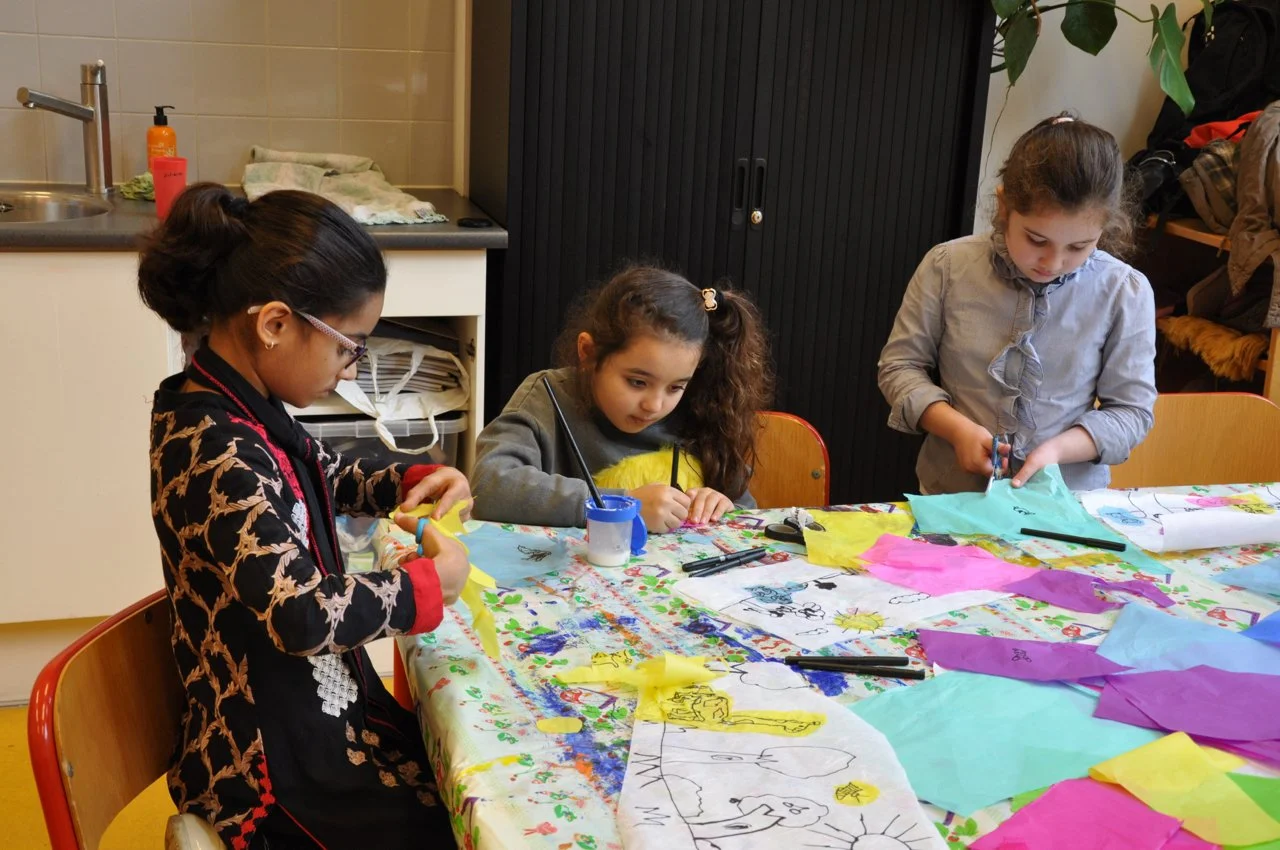
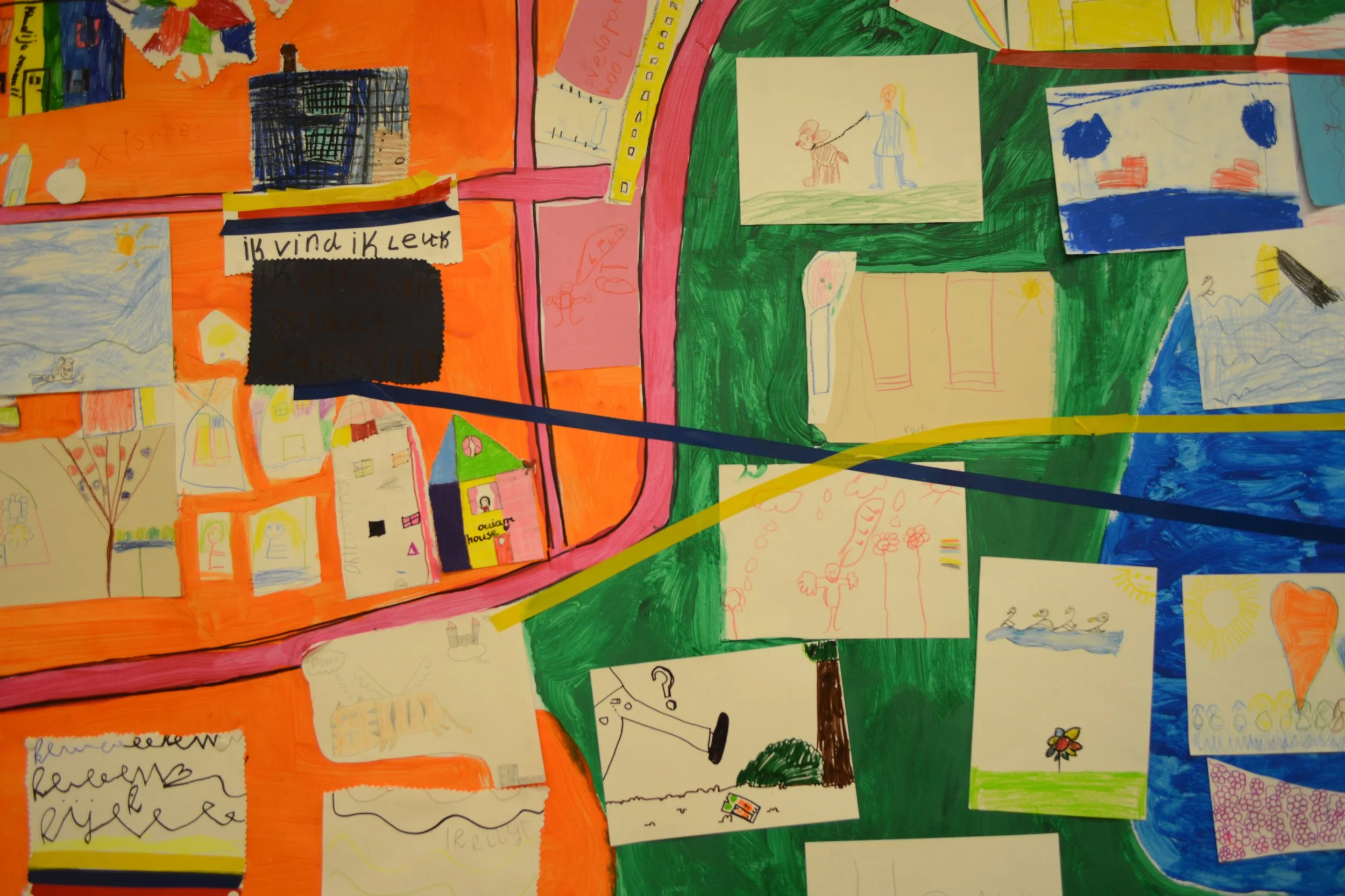
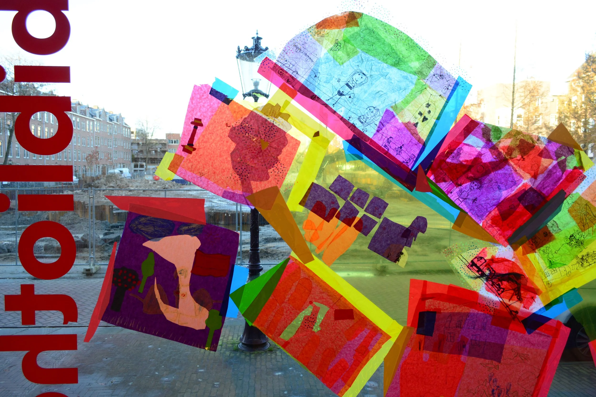
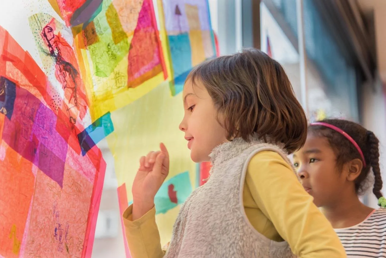
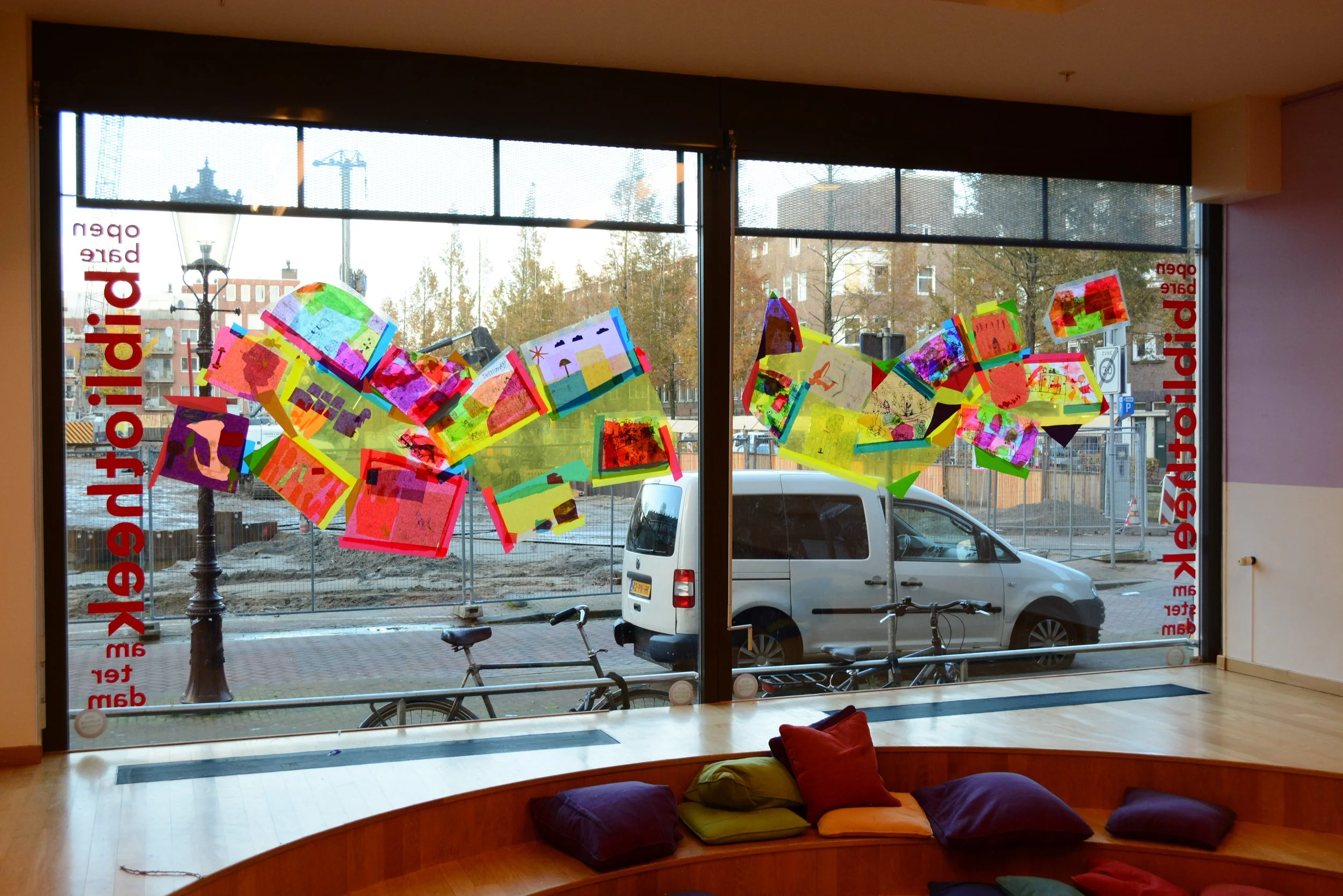
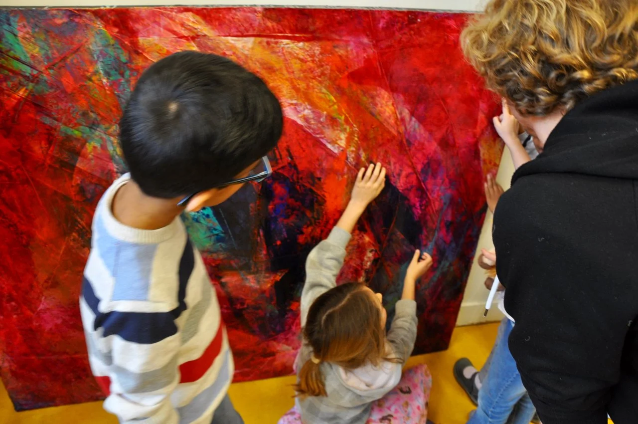
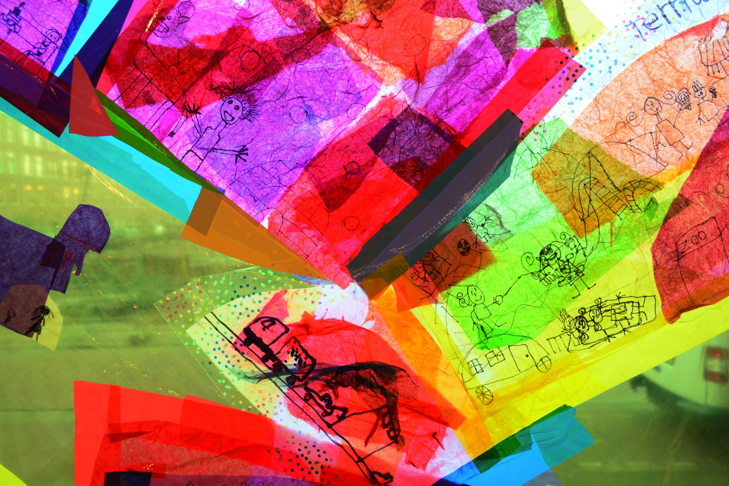
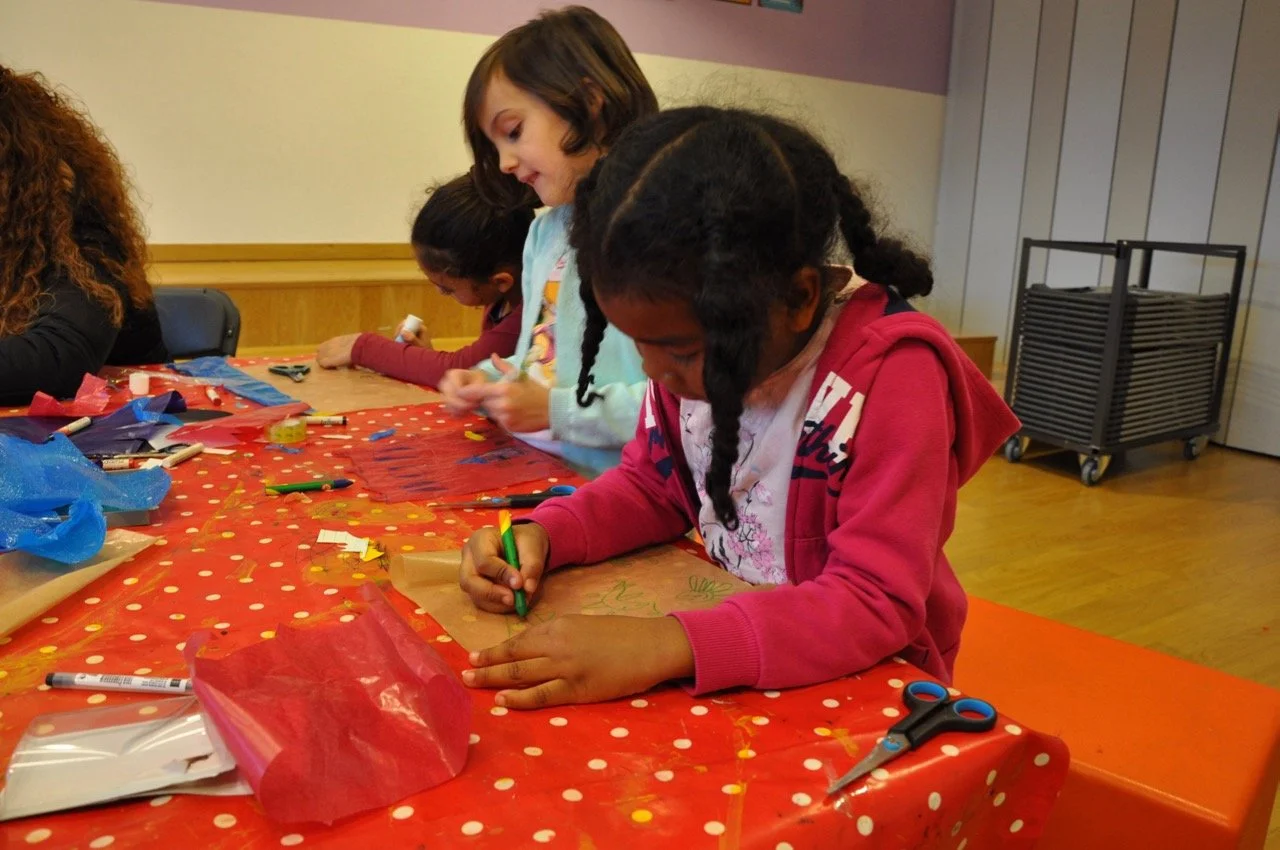
Dit is ons buurt/ This is our neighbourhood
I facilitated two map making workshops in Amsterdam with children aged between 6 and 10 based on their vision of our neighbourhood - de Indischebuurt (where I was also living at the time). I asked the children to imagine going on a walk from their house to their favourite place, and to make drawings of what they thought they would see, or hope to see along the way. We collaged the drawings to make a map of the local neighbourhood.
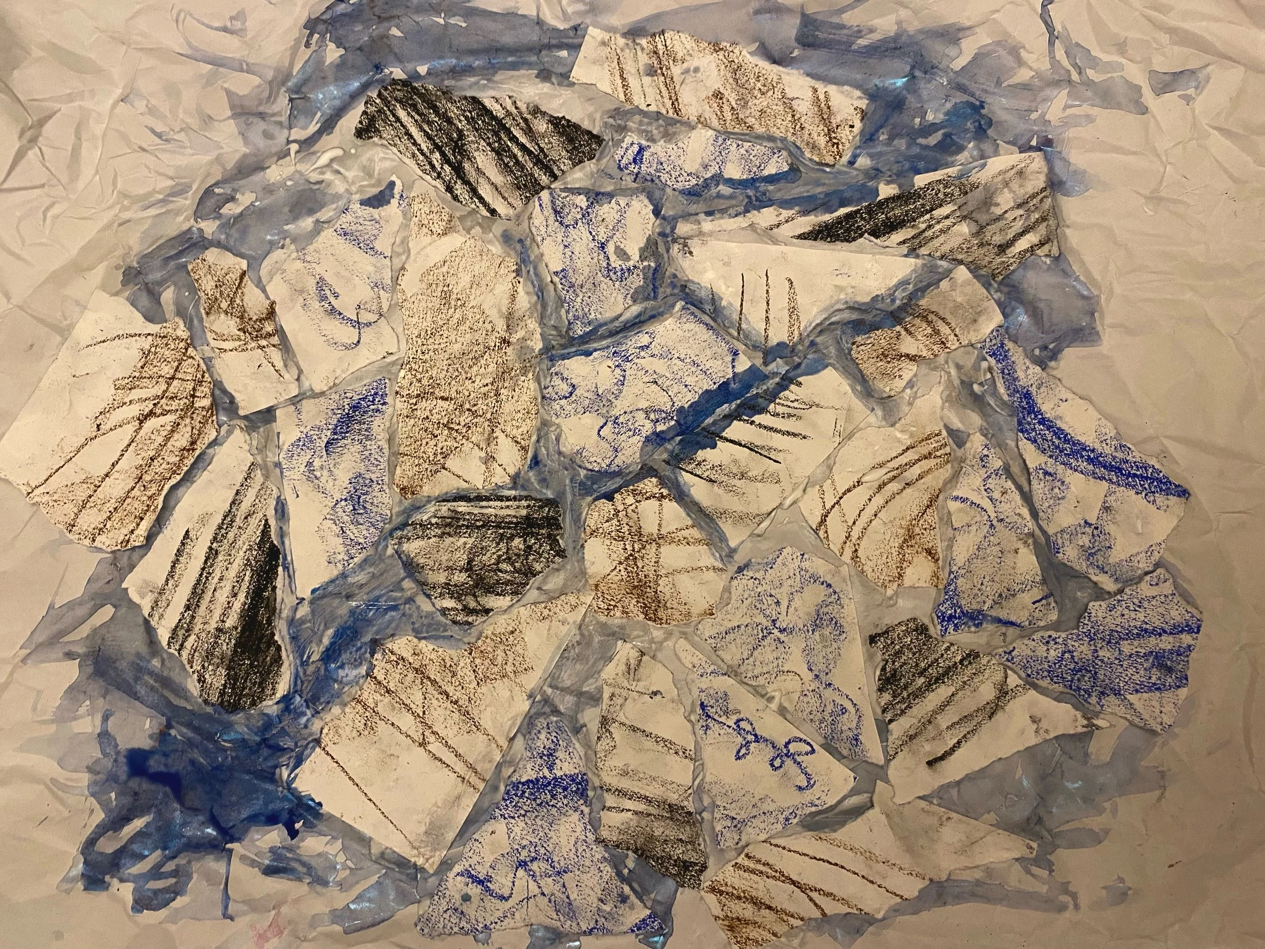
The second workshop was about using layers and inspired by looking at my paintings. We worked with coloured plastic sheets, drawing and laminated tissue paper with glue to make transparent collages of their favourite places in the neighbourhood.
Both pieces were exhibited at Amsterdam Public Library, and supported by Het Buurtatelier in 2016 and 2017

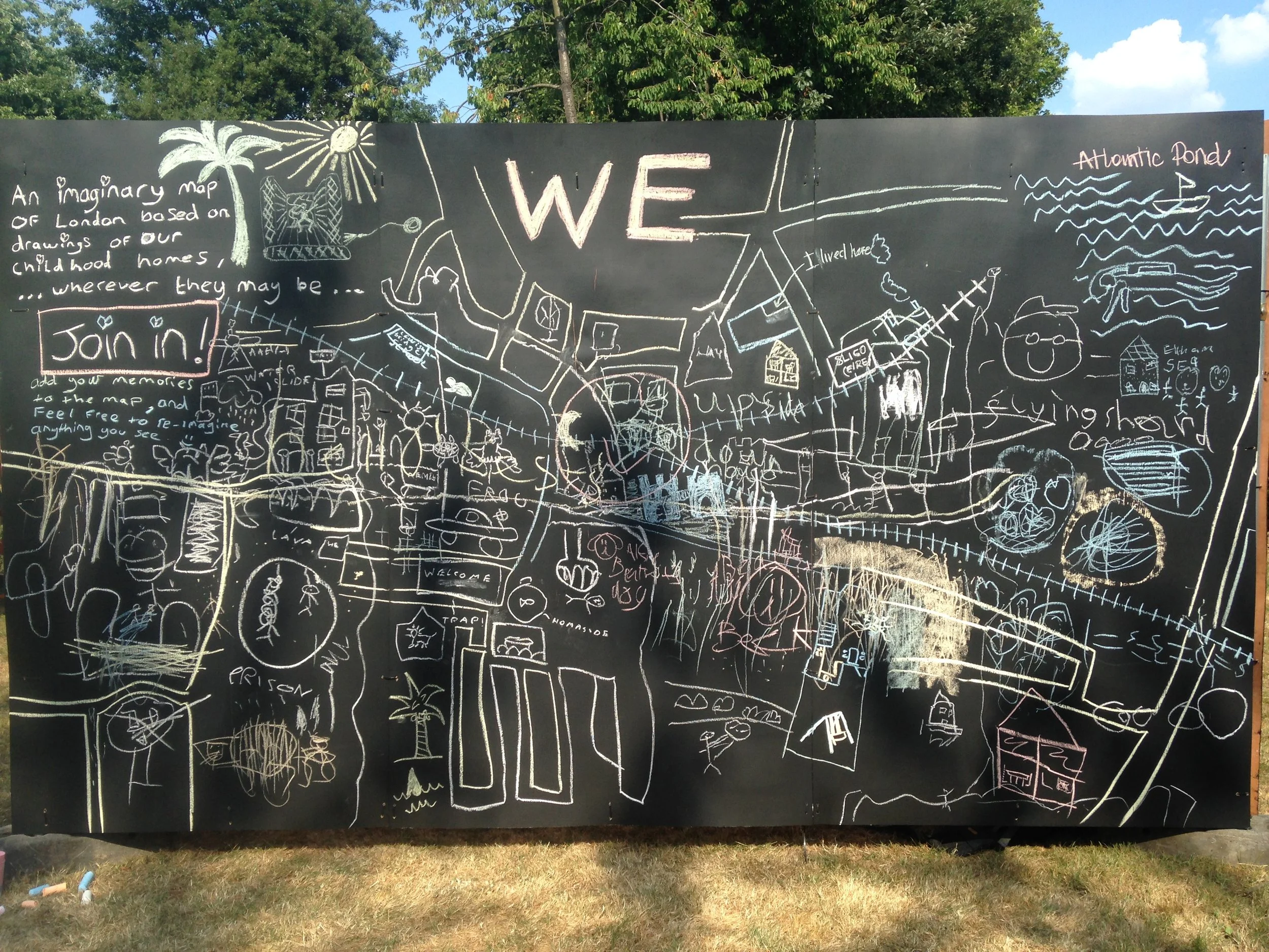
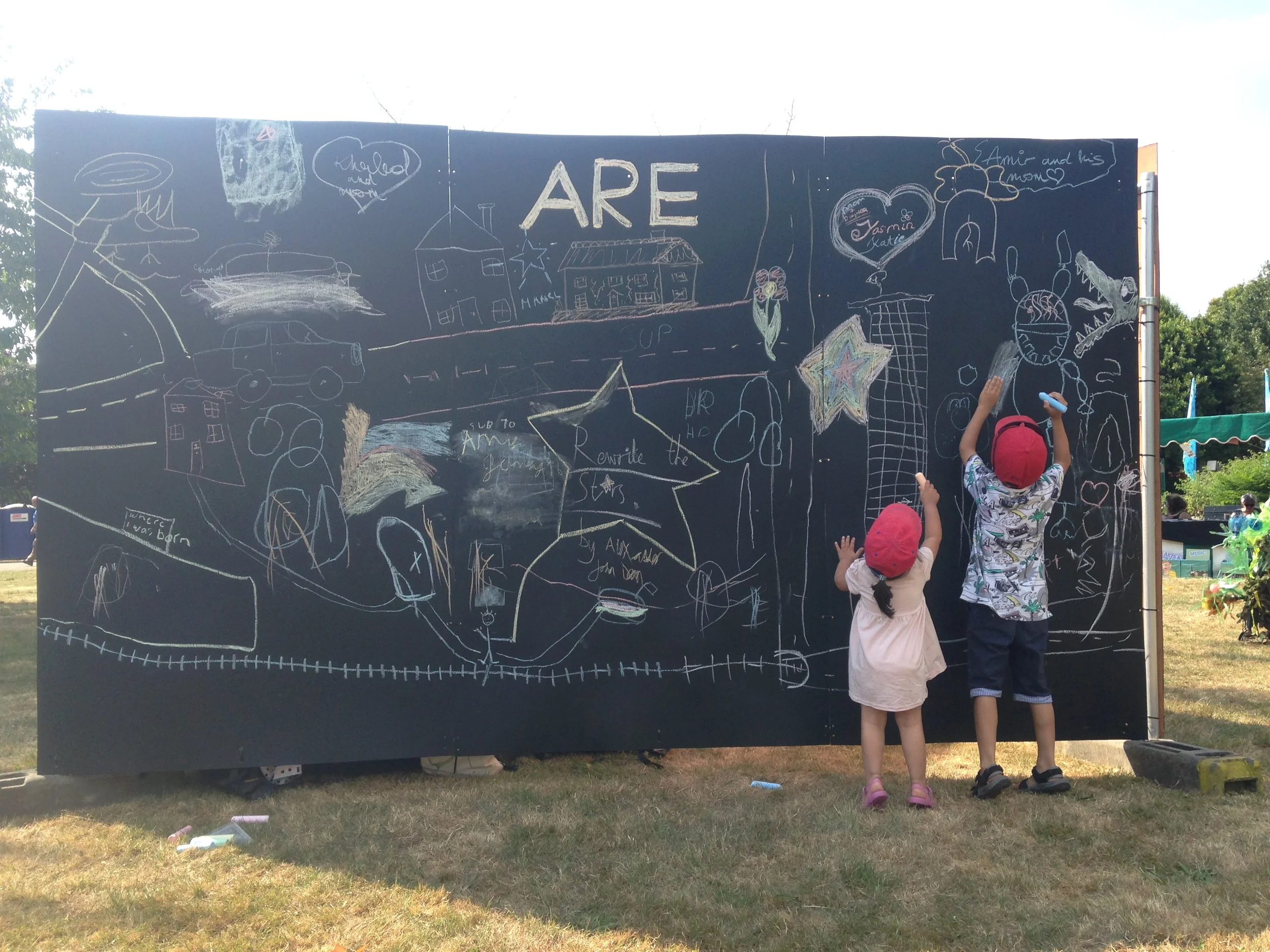
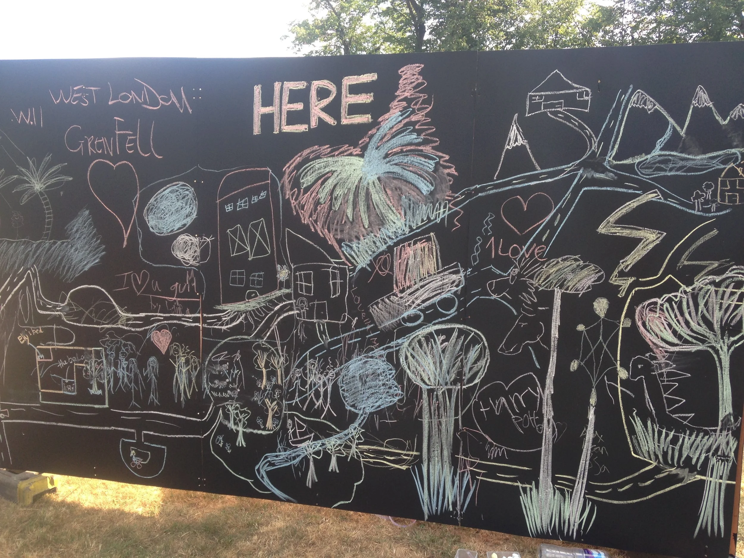
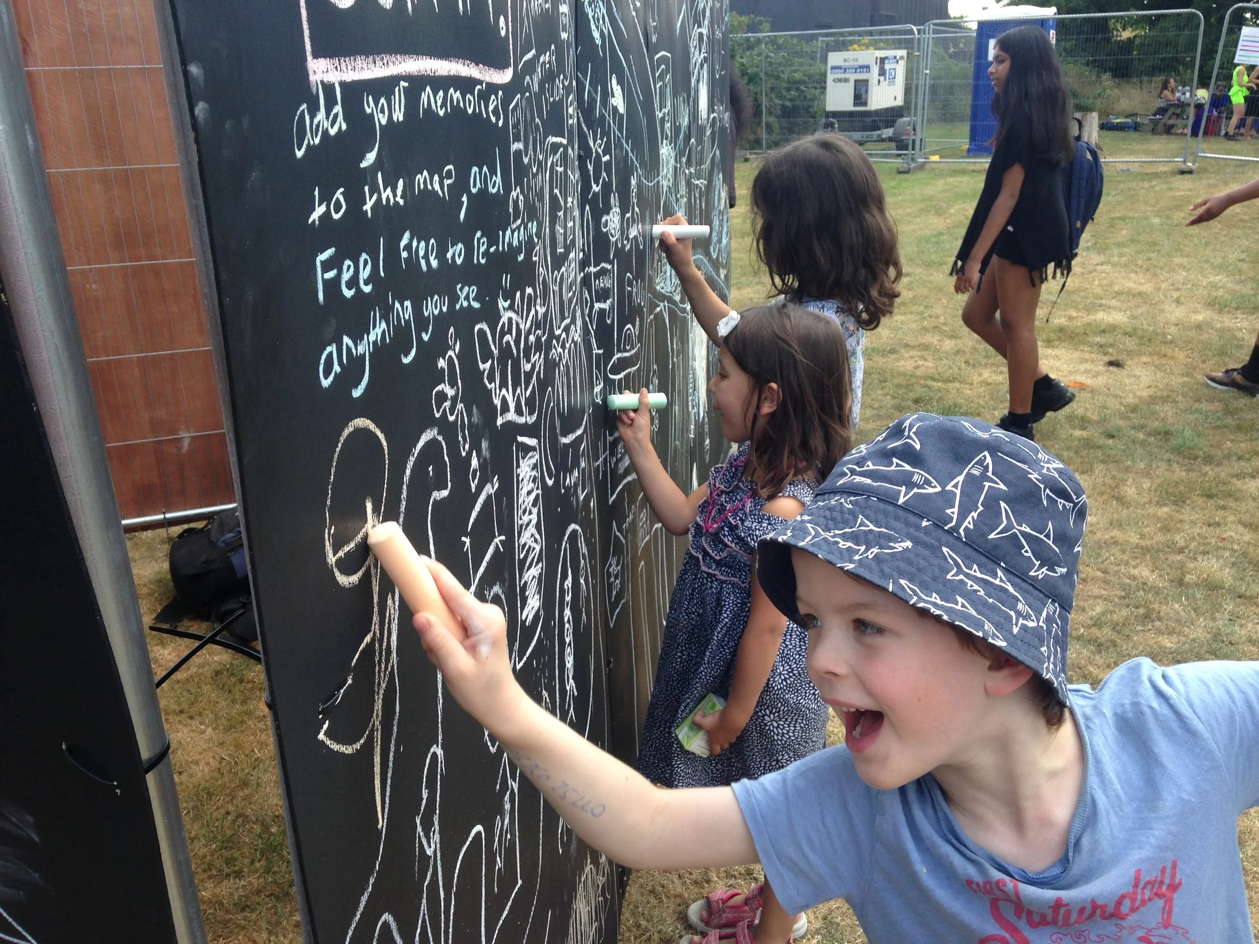
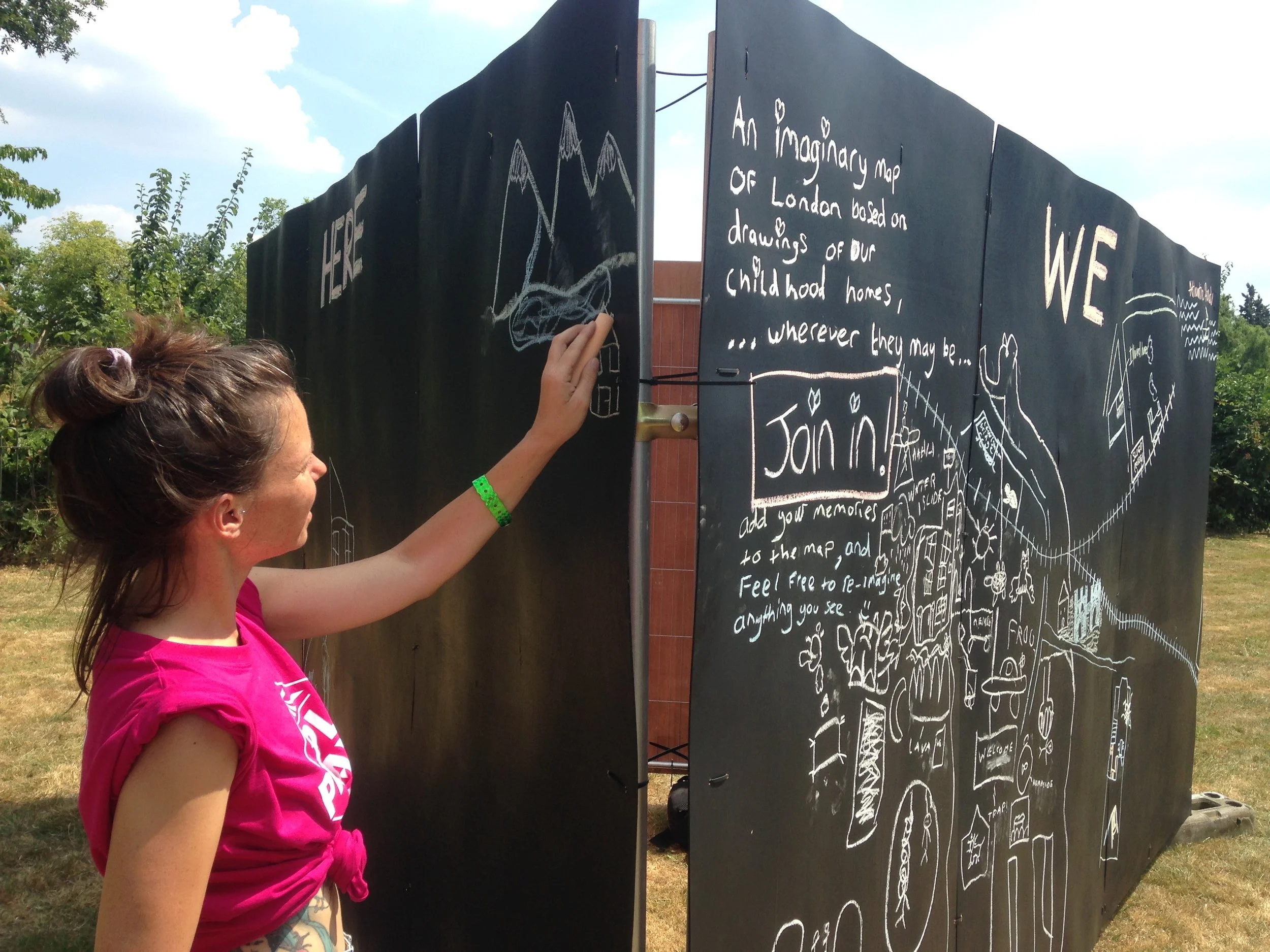
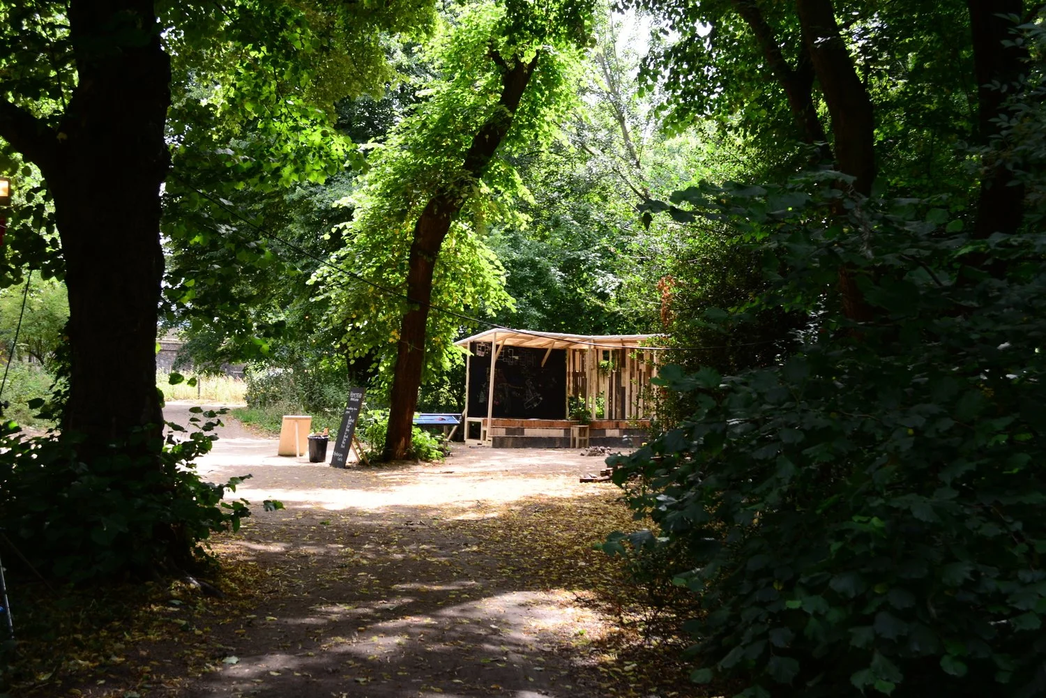
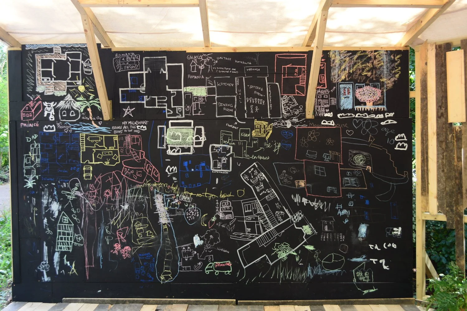
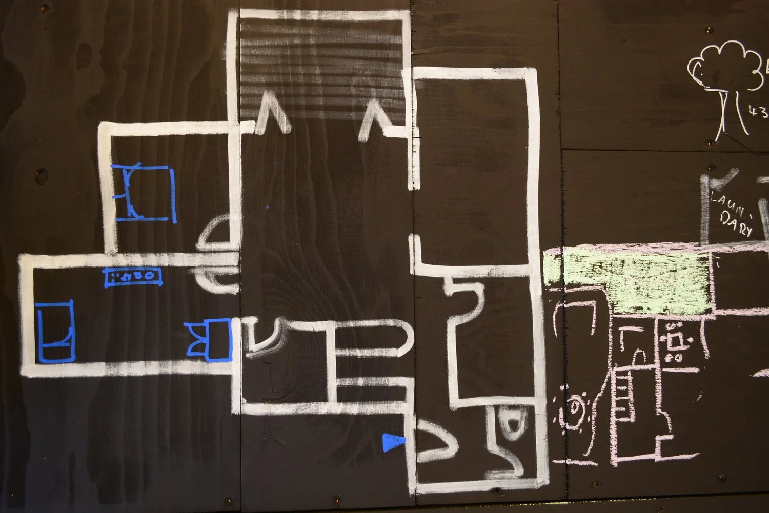
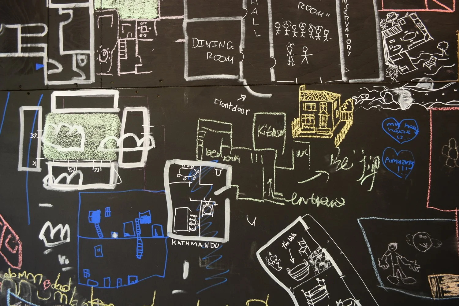
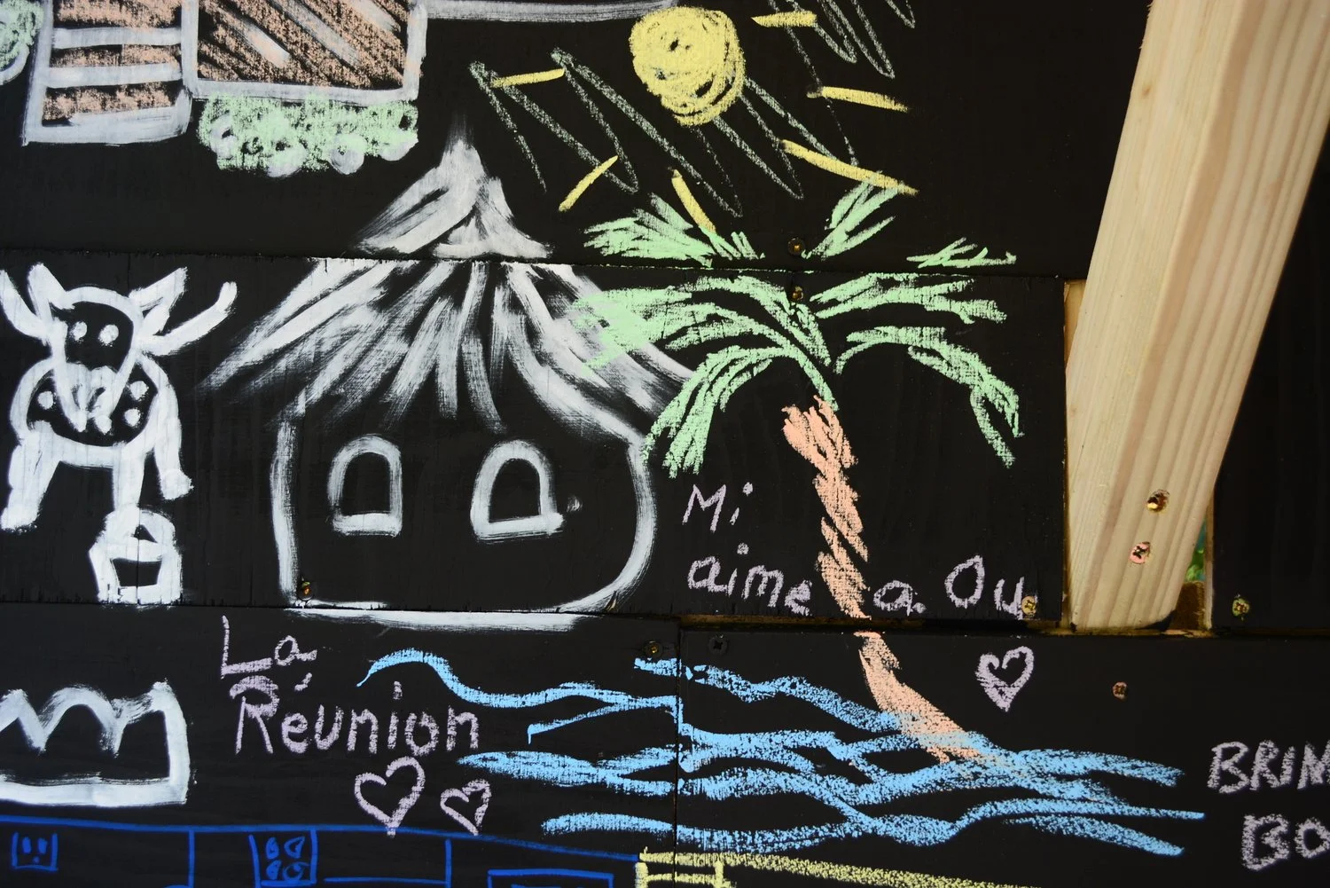
We Are Here/ Memory Map
We Are Here (Lewisham People’s Day, 2018) and Memory Map (Shuffle Festival, 2015) were participatory mapping projects which sought to explore the relationship between memory, fantasy and home. Visitors to the festivals, which were both held in London parks, were invited to contribute a drawing of their childhood home to a chalkboard. The drawings could be added on to the board wherever they could find space or wanted it to be, joining on to other houses that were already there. As more drawings of houses were added to the board, a map began to emerge with imaginary streets and neighbourhoods. A city as a collection of memories from different places as well as from just around the corner.